
| Area | Lagunitas Creek |
| Topic | Flow: San Geronimo Cr at Lagunitas Rd Bridge - Annual Peaks 1980-2001 |
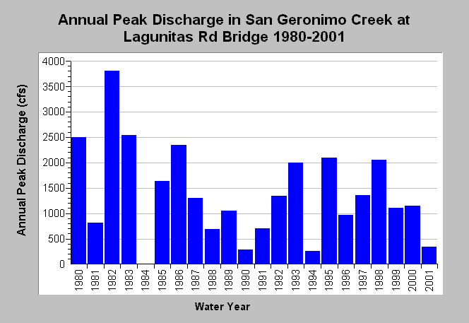
| Caption: This chart displays annual peak discharge (cfs) San Geronimo Creek at the Lagunitas Road Bridge. The highest peak of record occurred in 1982 and reached 3810 cfs. Annual peak flow discharge data were compiled from instantaneous stream gauge measurements. Data were collected by Balance Hydrologics, Inc. for the Marin Municipal Water District. See Info Links for more information. | |
 |
To learn more about this topic click Info Links .
To view additional information (data source, aquisition date etc.) about this page, click Metadata .
To view the table with the chart's data, click Chart Table web page.
To download the table with the chart's data, click flow_geronimo_lagbridge_peak_1980_2001.dbf (size 516 bytes) .
| www.krisweb.com |