
| Area | Lagunitas Creek |
| Topic | Land Cover: EPA Land Use in Lagunitas Creek Sub-basin 1992 |
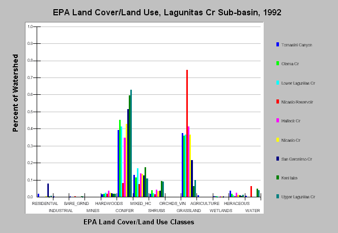
| Caption: This chart displays U.S. Environmental Protection Agency (EPA) Land Cover/Land Use data by Calwater Planning Watershed for the Lagunitas sub-basin. Classes are derived from a 1992 Landsat image. Calwaters are dominated by grassland and conifer forests with the Upper Lagunitas, Kent Lake and San Geronimo Calwaters have the greatest component of the latter. San Geronimo Creek contains 8% residential area. See Map to view the EPA Land Cover/Land Use GIS layer and Info Links for more information. | |
 |
To learn more about this topic click Info Links .
To view additional information (data source, aquisition date etc.) about this page, click Metadata .
To view the table with the chart's data, click Chart Table web page.
To download the table with the chart's data, click epa_landcover_calwaters.dbf (size 6,582 bytes) .
To view the table with the chart's source data, click Source Table web page.
To download the table with the chart's source data, click epa_calwater_land_cover.dbf (size 7,986 bytes)
| www.krisweb.com |