
| Area | Lagunitas Creek |
| Topic | Sediment: SG to DG - Embeddedness 1979-2000 |
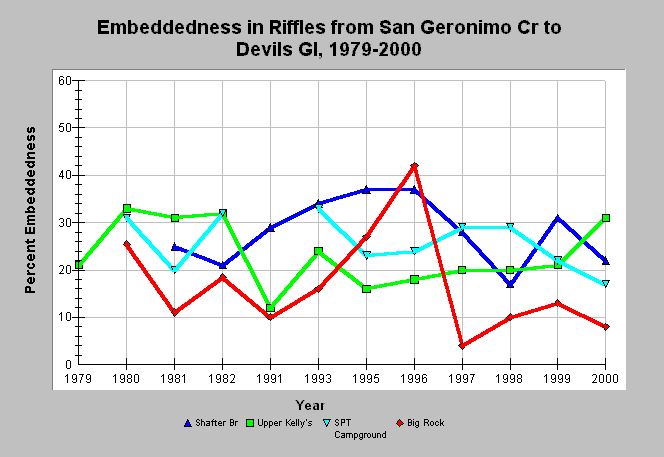
| Caption: This chart shows cobble embeddedness measurements in Lagunitas Creek riffles at monitoring sites between San Geronimo Creek and Devils Gulch from 1979 to 2000. Data were collected by Balance Hydrologics, Inc. for the Marin Municipal Water District. See Map to view sediment sampling locations and Info Links for more information. | |
 |
To learn more about this topic click Info Links .
To view additional information (data source, aquisition date etc.) about this page, click Metadata .
To view the table with the chart's data, click Chart Table web page.
To download the table with the chart's data, click sed_lag_emb_cross.db (size 4,096 bytes) .
To view the table with the chart's source data, click Source Table web page.
To download the table with the chart's source data, click sediment_lagunitas_wolman_balance_1979_2000.xls.db (size 16,384 bytes)
| www.krisweb.com |