
| Area | Lagunitas Creek |
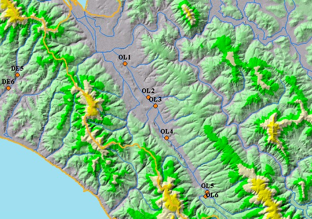
| Topic | Aquatic Invertebrates: Olema Creek Percent Dominant Taxa 1999 |
| This is a map of Point Reyes National Seashore (PORE) macroinvertebrate sampling stations in Olema Creek. Olema macroinvertebrate sites are labeled OL1, OL2, OL3, OL4, OL5 and OL6. Displayed in the background are sub-basins and 1:100,000 scale USGS hydrography. | |||
 |
 |
||
To view metadata about a map layer, click on a link in the table below.
| Name of Layer in Map Legend | Metadata File Name |
|---|---|
| Macroinvertebrate Points (PORE) | wqpoints_bugs.shp.txt |
| Subbasins (no labels) | subbasins.shp.txt |
| Frame Project Outline | Unavailable |
| Streams (1:100k scale)(no labels) | streams100.shp.txt |
| Topo Map, South (1:24k scale) | Unavailable |
| Elevation (10 m resolution) | elev10.tif.txt |
| Pt. Reyes National Seashore Map | Unavailable |
| Project Background | Unavailable |
| www.krisweb.com |