| Area |
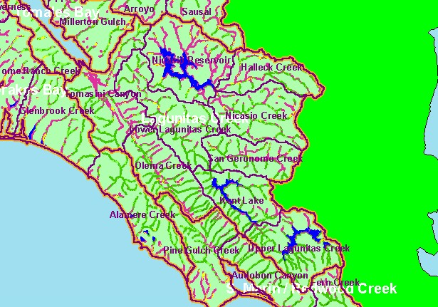
Lagunitas Creek |
| Topic |
Land Cover: USFS Veg Size in Lagunitas Creek Riparian Zones 1994 |
|
This is a map of 1994 USFS Landsat vegetation size data within 90-meter riparian buffer zones in the Lagunitas Creek sub-basin.
Use the Pan (hand icon) and Zoom (magnifying glass icons) tools to move around the map.
|
|
|
 |
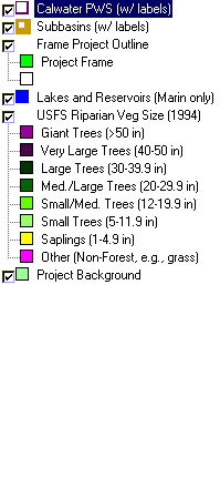 |
To view metadata about a map layer, click on a link in the table below.
| Name of Layer in Map Legend | Metadata File Name |
|---|
| Calwater PWS (w/ labels) | calw22.shp.txt |
| Subbasins (w/ labels) | subbasins.shp.txt |
| Frame Project Outline | Unavailable |
| Lakes and Reservoirs (Marin only) | Unavailable |
| USFS Riparian Veg Size (1994) | vegsizebuf.tif.txt |
| USFS Vegetation Size (1994) | vegsize.tif.txt |
| Topo Map, North (1:24k scale) | Unavailable |
| Topo Map, South (1:24k scale) | Unavailable |
| Project Background | Unavailable |
