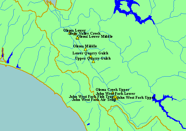
| Area |
Lagunitas Creek |
| Topic |
Temperature: Quarry Gulch Lower Min, Max and Average 2000 |
|
Scale = 1:124,689 .
|
|
|
 |
 |
To view metadata about a map layer, click on a link in the table below.
| Name of Layer in Map Legend | Metadata File Name |
|---|
| Olema Temperature Points | temploggers.shp.txt |
| Subbasins (no labels) | subbasins.shp.txt |
| Frame Project Outline | Unavailable |
| Lakes and Reservoirs | Unavailable |
| Streams (1:100k scale)(no labels) | streams100.shp.txt |
| Topo Map, South (1:24k scale) | Unavailable |
| Elevation (10 m resolution) | elev10.tif.txt |
| Pt. Reyes National Seashore Map | Unavailable |
| Project Background | Unavailable |
