| Area |
Lagunitas Creek |
| Topic |
Tour: Channel Evaluation of Lagunitas Creek |
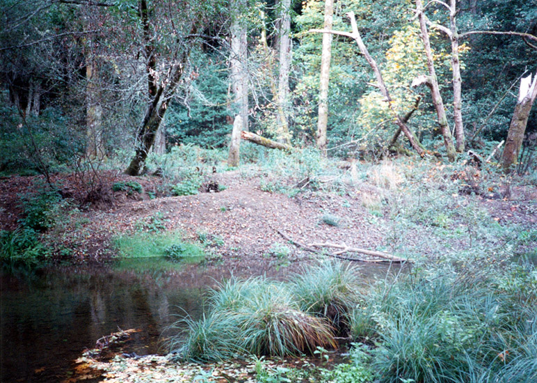
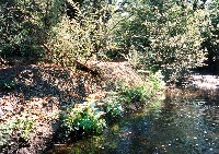 Click on image to enlarge (319K).
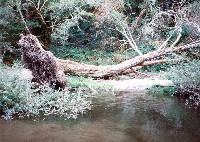
This gravel bar, formed in association with a logjam, is typical of the McIsaac Barn Reach. These bars store a significant amount of sediment. Photo taken in 1995 and provided courtesy of Marin Resource Conservation District and Prunuske Chatham Inc. Associated caption taken from PCI, 1996.
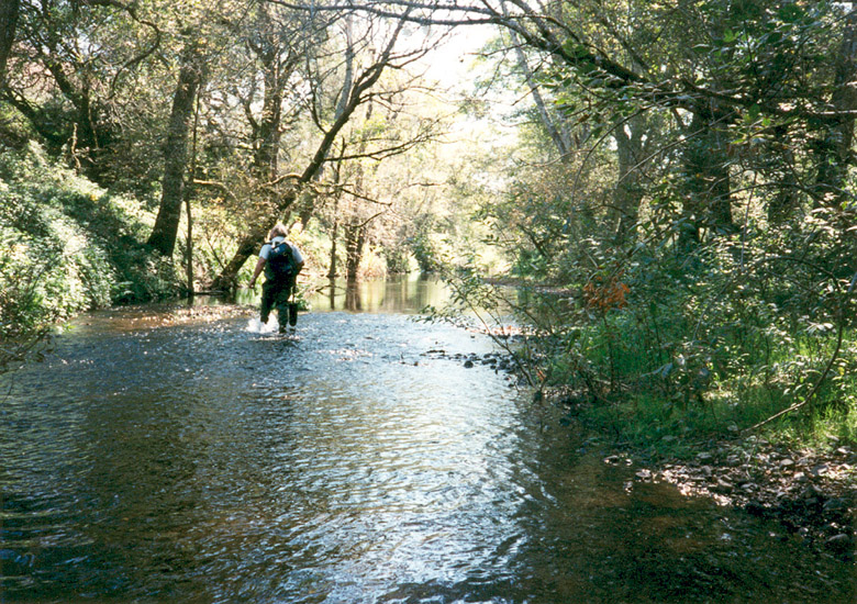
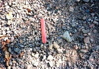 Click on image to enlarge (55K). Click here to display a larger version (284K).
These grayish, low-hue sands and gravels are typical of sediment in the lower reaches of Lagunitas Creek, from Tocaloma Bridge to Cheda Creek. Photo taken in 1995 and provided courtesy of Marin Resource Conservation District and Prunuske Chatham Inc. Associated caption taken from PCI, 1996.
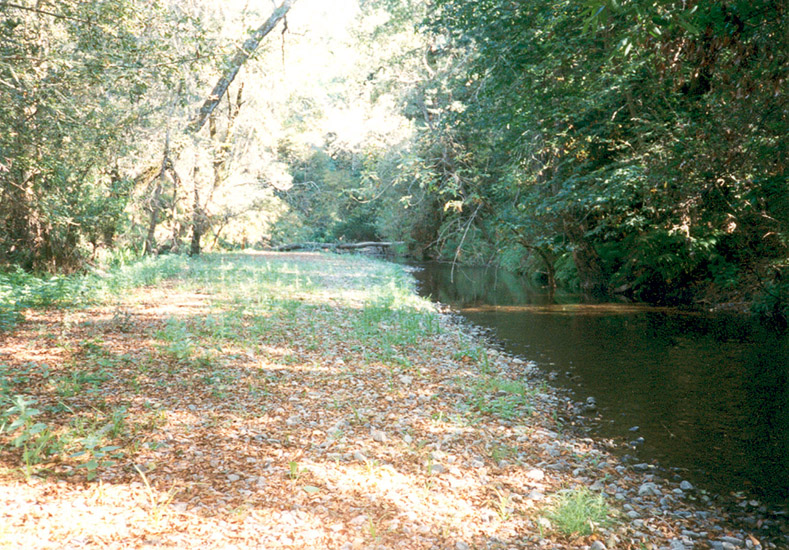
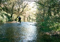 Click on image to enlarge (44K). Click here to display a larger version (274K).
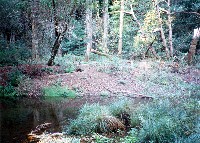
Kelley's and Upper Tocaloma reaches are shaded with galleries of mature alder. An alternative channel, once the active channel of the creek and still used during peak flows, is out of the picture to the right. Photo taken in 1995 and provided courtesy of Marin Resource Conservation District and Prunuske Chatham Inc. Associated caption taken from PCI, 1996.
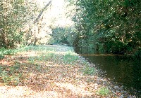 Click on image to enlarge (40K). Click here to display a larger version (260K).
This lateral bar that is armored with cobble shows how sediment constricts the low-flow channel in the reaches between Cheda Creek and Big Bend. Picture was taken in 1995. Photo taken in 1995 and provided courtesy of Marin Resource Conservation District and Prunuske Chatham Inc. Associated caption taken from PCI, 1996.
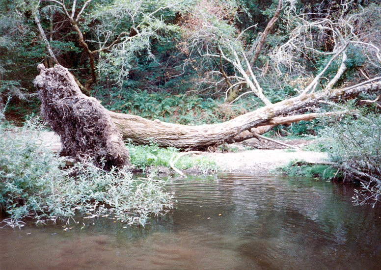
 Click on image to enlarge (42K). Click here to display a larger version (249K).
When standing, this alder was located on a cross section at the Big Bend study site. Both long-term trends and sudden changes are considered by the detailed surveys on Lagunitas Creek. Picture was taken in 1995. Photo taken in 1995 and provided courtesy of Marin Resource Conservation District and Prunuske Chatham Inc. Associated caption taken from PCI, 1996.
 Click on image to enlarge (43K). Click here to display a larger version (265K).
This reddish sediment was deposited by a Big Bend tributary during high flows in 1995, and was visible for more than 2,000 feet downstream. Picture was taken in 1995. Photo taken in 1995 and provided courtesy of Marin Resource Conservation District and Prunuske Chatham Inc. Associated caption taken from PCI, 1996.
 Click on image to enlarge (38K). Click here to display a larger version (229K).
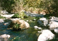
The bedrock pools found between Big Bend and Big Rock are relatively clean of sand and fine gravels, probably due to high flows and reservoir releases in 1995. Picture was taken in 1995. Photo taken in 1995 and provided courtesy of Marin Resource Conservation District and Prunuske Chatham Inc. Associated caption taken from PCI, 1996.
 Click on image to enlarge (32K). Click here to display a larger version (192K).
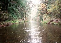
For the first time since observations began in 1979, the Upper State Park Reach showed larger sediment sizes in the streambed, with improved cover for juvenile salmonids. Photo taken in 1995 and provided courtesy of Marin Resource Conservation District and Prunuske Chatham Inc. Associated caption taken from PCI, 1996.
To learn more about this topic click Info Links
To view additional information (data source, aquisition date etc.) about this page, click Metadata

 Click on image to enlarge (319K).
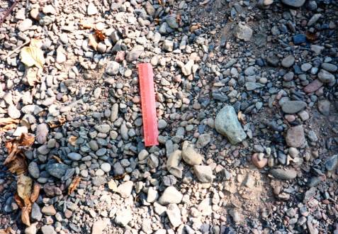 Click on image to enlarge (55K). Click here to display a larger version (284K).
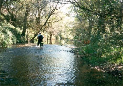 Click on image to enlarge (44K). Click here to display a larger version (274K).
 Click on image to enlarge (40K). Click here to display a larger version (260K).
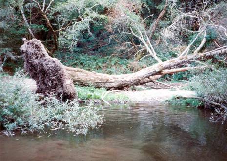 Click on image to enlarge (42K). Click here to display a larger version (249K).
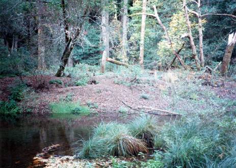 Click on image to enlarge (43K). Click here to display a larger version (265K).
 Click on image to enlarge (38K). Click here to display a larger version (229K).
 Click on image to enlarge (32K). Click here to display a larger version (192K).
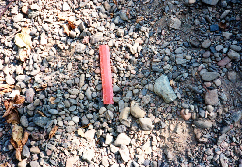