| Area |
Lagunitas Creek |
| Topic |
Tour: Cheda Creek Restoration, Before and During |
 Click on image to enlarge (45K). Click here to display a larger version (215K).
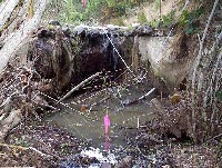
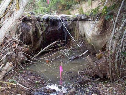
This photo shows a degraded section of Cheda Creek before restoration activities. It is likely that this sill was caused by head cutting and was an impediment to adult steelhead migration. Photos provided courtesy of the Point Reyes National Seashore, U.S. National Park Service.
 Click on image to enlarge (42K). Click here to display a larger version (212K).
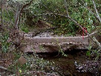
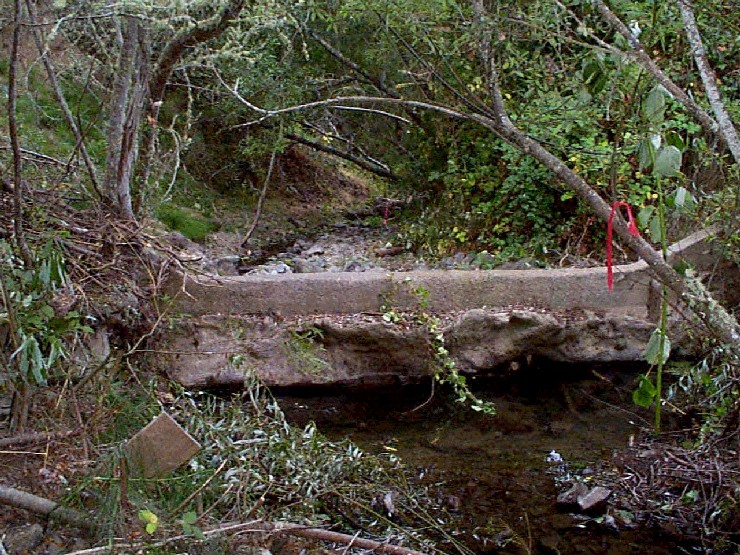
Concrete sill left from an old dam or road crossing road crossing is shown on Cheda Creek before restoration activities. Photos provided courtesy of the Point Reyes National Seashore, U.S. National Park Service.
 Click on image to enlarge (30K). Click here to display a larger version (170K).
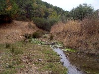
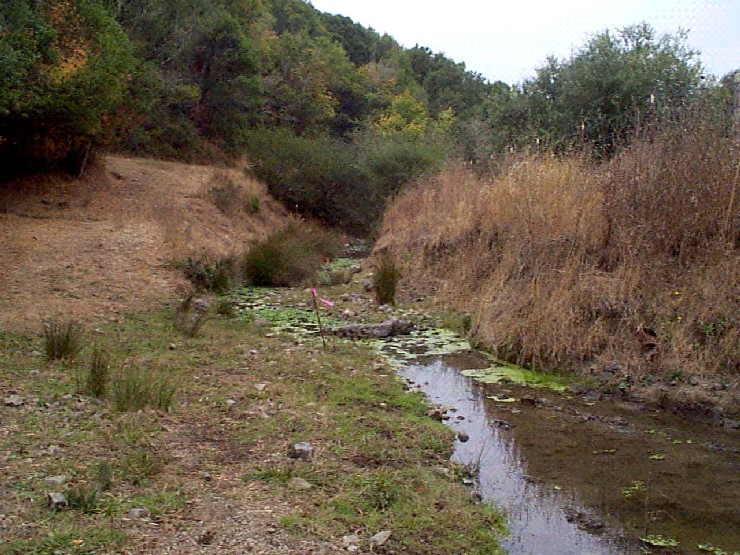
This photo shows Cheda Creek in a wide open reach profoundly effected by past land use. The road at left is now vegetated but would have formerly been a chronic source of sediment. The algae bloom visible in the creek could cause swings in dissolved oxygen. Photos provided courtesy of the Point Reyes National Seashore, U.S. National Park Service.
 Click on image to enlarge (52K). Click here to display a larger version (241K).
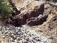
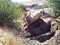
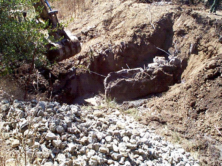
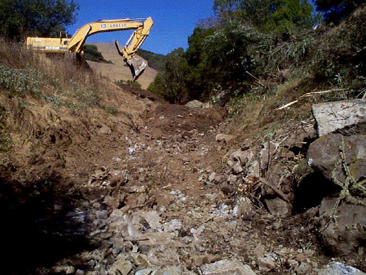
Heavy equipment excavates materials that had filled in the channel of Cheda Creek. Photos provided courtesy of the Point Reyes National Seashore, U.S. National Park Service.
 Click on image to enlarge (47K). Click here to display a larger version (228K).
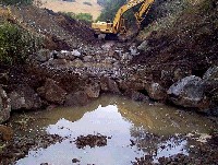
Excavator attempts to remove material down to the former grade of Cheda Creek as part of a restoration project. Photos provided courtesy of the Point Reyes National Seashore, U.S. National Park Service.
 Click on image to enlarge (36K). Click here to display a larger version (183K).
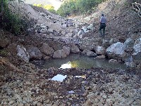
Newly created channel for Cheda Creek in an area that was formerly filled in by land use activities. Photos provided courtesy of the Point Reyes National Seashore, U.S. National Park Service.
 Click on image to enlarge (35K). Click here to display a larger version (180K).
Excavator completes work in stream channel of Cheda Creek, which has chains of boulders installed as weir to create habitat diversity. Photos provided courtesy of the Point Reyes National Seashore, U.S. National Park Service.
 Click on image to enlarge (37K). Click here to display a larger version (191K).
This photo shows the reconstructed channel of Cheda Creek with cobble and gravel size rocks imported to armor the excavated stream bed. See the next Picture Tour for more photos of the project after completion. Photos provided courtesy of the Point Reyes National Seashore, U.S. National Park Service.
To learn more about this topic click Info Links
To view additional information (data source, aquisition date etc.) about this page, click Metadata

 Click on image to enlarge (45K). Click here to display a larger version (215K).
 Click on image to enlarge (42K). Click here to display a larger version (212K).
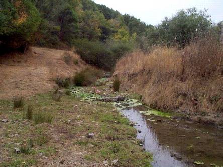 Click on image to enlarge (30K). Click here to display a larger version (170K).
 Click on image to enlarge (52K). Click here to display a larger version (241K).
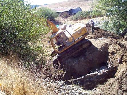 Click on image to enlarge (47K). Click here to display a larger version (228K).
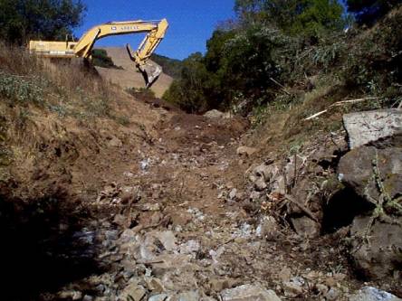 Click on image to enlarge (36K). Click here to display a larger version (183K).
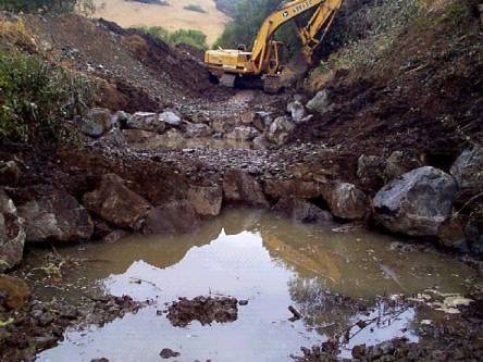 Click on image to enlarge (35K). Click here to display a larger version (180K).
 Click on image to enlarge (37K). Click here to display a larger version (191K).
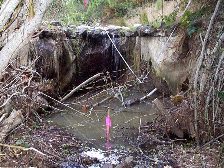