| Area |
Lagunitas Creek |
| Topic |
Tour: Cheda Creek After Restoration |
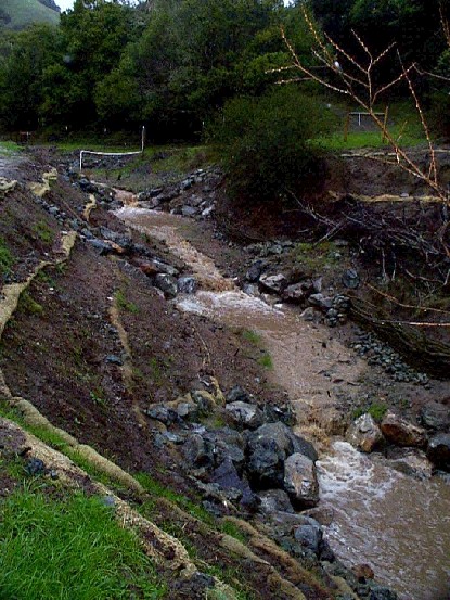
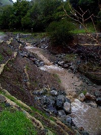 Click on image to enlarge (111K).
This photo shows the Cheda Creek project just after completion with its first flushing flow. Subsequent flows had less elevated turbidity (see Picture #3). Photos provided courtesy of the Point Reyes National Seashore, U.S. National Park Service.
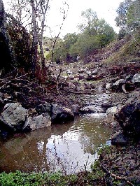
 Click on image to enlarge (37K). Click here to display a larger version (191K).
Reconstructed Cheda Creek channel now armored with native as well as imported materials after high flows. The willow wall at right has been constructed with other bioengineering projects (see Picture #6). Photos provided courtesy of the Point Reyes National Seashore, U.S. National Park Service.
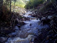 Click on image to enlarge (33K). Click here to display a larger version (170K).
This photo of the Cheda Creek restoration project shows the stream at higher flows. Note that turbidity is less than just after project completion. Photos provided courtesy of the Point Reyes National Seashore, U.S. National Park Service.
 Click on image to enlarge (123K).
This photo shows Cheda Creek restored area with willow sprigs planted in the foreground (lower right) as well as along both banks upstream. See Picture #7 for more advance revegetation at this site. Photos provided courtesy of the Point Reyes National Seashore, U.S. National Park Service.
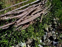 Click on image to enlarge (48K). Click here to display a larger version (225K).
Close up of willow waddle which not only armors the stream bank but sprouts live willow trees. The roots of these trees will hold existing bank materials and trap sediment as trees mature. Photos provided courtesy of the Point Reyes National Seashore, U.S. National Park Service.
 Click on image to enlarge (41K). Click here to display a larger version (201K).
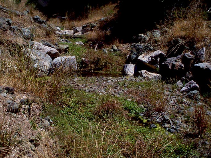
Channel of Cheda Creek after several years has grasses and young willows coming in. Photos provided courtesy of the Point Reyes National Seashore, U.S. National Park Service.
 Click on image to enlarge (35K). Click here to display a larger version (173K).
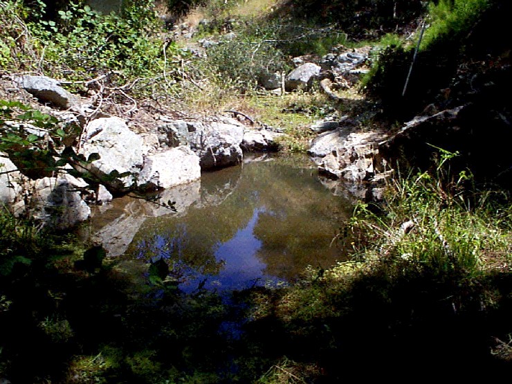
This photo shows a pool in the reconstructed reach of Cheda Creek. Riparian restoration results show in improved bank cover and some shade developing. Photos provided courtesy of the Point Reyes National Seashore, U.S. National Park Service.
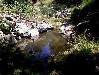
 Click on image to enlarge (43K). Click here to display a larger version (211K).
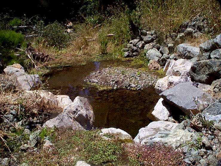
Isolated pool in restored reach of Cheda Creek during low flow conditions. Spawning gravel substrate is starting to sort in the back of the pool formed by the boulder weir. Isolated pools can sometimes provide summer rearing habitat for juvenile steelhead. Photos provided courtesy of the Point Reyes National Seashore, U.S. National Park Service.
To learn more about this topic click Info Links
To view additional information (data source, aquisition date etc.) about this page, click Metadata

 Click on image to enlarge (111K).
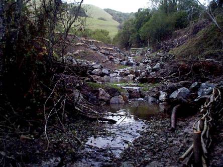 Click on image to enlarge (37K). Click here to display a larger version (191K).
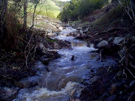 Click on image to enlarge (33K). Click here to display a larger version (170K).
 Click on image to enlarge (123K).
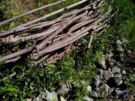 Click on image to enlarge (48K). Click here to display a larger version (225K).
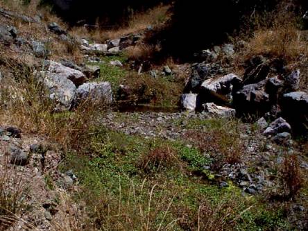 Click on image to enlarge (41K). Click here to display a larger version (201K).
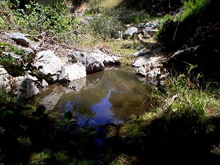 Click on image to enlarge (35K). Click here to display a larger version (173K).
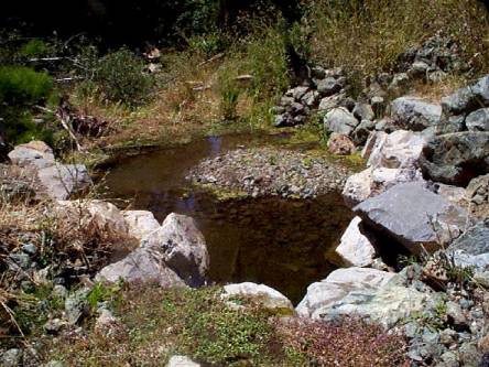 Click on image to enlarge (43K). Click here to display a larger version (211K).
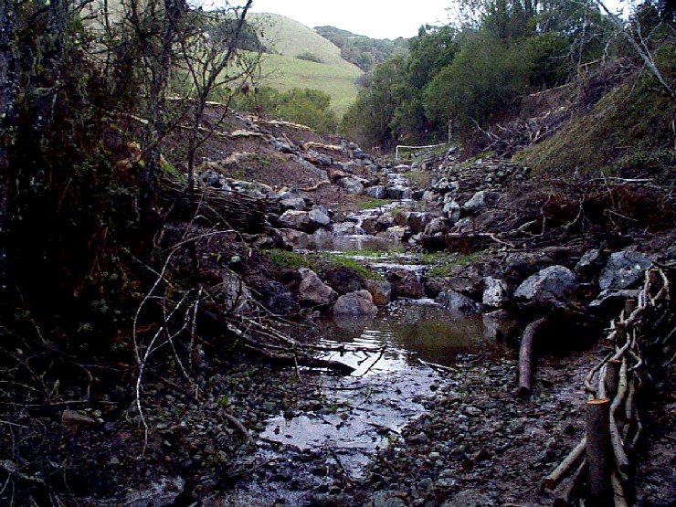