| Area |
Lagunitas Creek |
| Topic |
Tour: Cheda Creek Restoration, Before/After Comparisons |
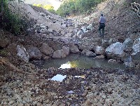
 Click on image to enlarge (30K). Click here to display a larger version (170K).
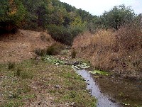
This before photo shows the open channel of Cheda Creek with algae growing in the channel and little habitat for aquatic species or wildlife. See Picture #2 for after restoration. Photos provided courtesy of the Point Reyes National Seashore, U.S. National Park Service.
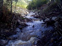
 Click on image to enlarge (115K).
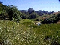
This photo shows the same location as Picture #1 with healthier riparian conditions and much more diverse aquatic habitat. See Picture #3 for another view of the reach above. Photos provided courtesy of the Point Reyes National Seashore, U.S. National Park Service.
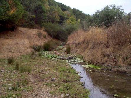
 Click on image to enlarge (32K). Click here to display a larger version (179K).
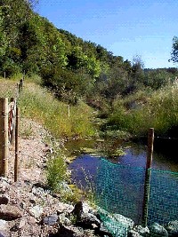
Restored reach of Cheda Creek formerly damaged by grazing. Riparian vegetation provides a filter for sediment or nutrients coming from uplands. Photos provided courtesy of the Point Reyes National Seashore, U.S. National Park Service.
 Click on image to enlarge (35K). Click here to display a larger version (180K).
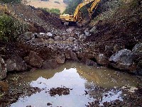
This picture shows the last of heavy equipment on the channel of Cheda Creek to recontour the stream to its former grade. See Pictures #5 and #6 for after shots of this same location. Photos provided courtesy of the Point Reyes National Seashore, U.S. National Park Service.
 Click on image to enlarge (37K). Click here to display a larger version (191K).
National Park Service personnel inspect newly excavated stream channel for Cheda Creek. See Picture #6 for the stream at high flows later. Photos provided courtesy of the Point Reyes National Seashore, U.S. National Park Service.
 Click on image to enlarge (33K). Click here to display a larger version (170K).
Restored reach of Cheda Creek with flows plunging over boulder weirs and vegetation starting to colonize banks. Photos provided courtesy of the Point Reyes National Seashore, U.S. National Park Service.
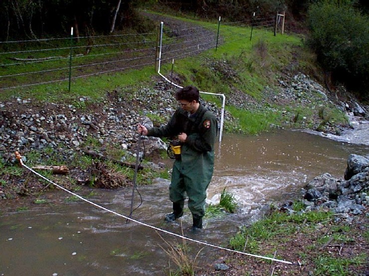
 Click on image to enlarge (34K). Click here to display a larger version (176K).
National Park Service staff from the Point Reyes National Seashore monitors flow on restored reach of Cheda Creek. Cheda Creek and other tributaries crossing the National Seashore are also monitored for water quality. Photos provided courtesy of the Point Reyes National Seashore, U.S. National Park Service.
To learn more about this topic click Info Links
To view additional information (data source, aquisition date etc.) about this page, click Metadata

 Click on image to enlarge (30K). Click here to display a larger version (170K).
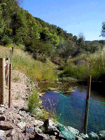 Click on image to enlarge (115K).
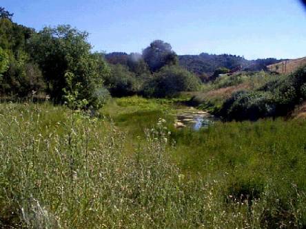 Click on image to enlarge (32K). Click here to display a larger version (179K).
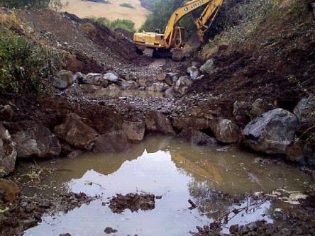 Click on image to enlarge (35K). Click here to display a larger version (180K).
 Click on image to enlarge (37K). Click here to display a larger version (191K).
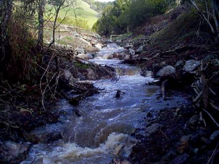 Click on image to enlarge (33K). Click here to display a larger version (170K).
 Click on image to enlarge (34K). Click here to display a larger version (176K).
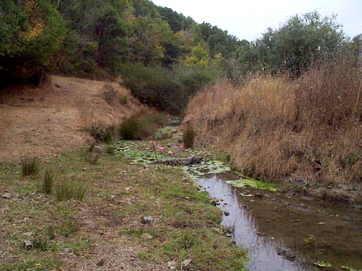