| Area |
Stemple Creek |
| Topic |
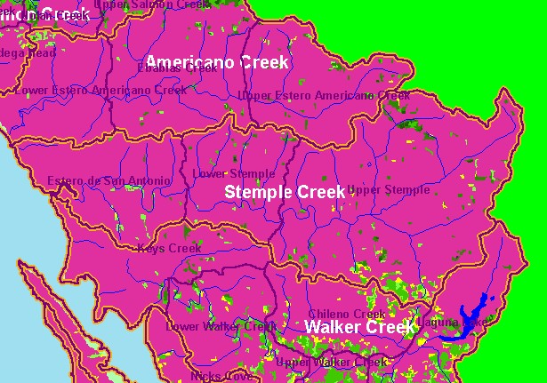
Land Cover: USFS Veg Size in Stemple Creek Sub-basin 1994 |
|
This is the 1994 USFS Landsat vegetation size data for the Stemple Creek sub-basin provided by the U.S. Forest Service Spatial
Analysis Lab in Sacramento, CA. Most of the area of the Stemple Creek watershed is in grasslands, which show up as Non-Forest
in this theme. Riparian patches are also showing around farm ponds which dot the landscape. The background themes displayed are
U.S. Geologic Survey 1:24000 hydrography and Calwater Planning Watersheds.
|
|
|
 |
 |
To view metadata about a map layer, click on a link in the table below.
| Name of Layer in Map Legend | Metadata File Name |
|---|
| Calwater PWS (w/ labels) | calw22.shp.txt |
| Subbasins (w/ labels) | subbasins.shp.txt |
| Frame Project Outline | Unavailable |
| Lakes and Reservoirs (Marin only) | Unavailable |
| Streams (1:100k scale)(no labels) | streams100.shp.txt |
| USFS Riparian Veg Size (1994) | vegsizebuf.tif.txt |
| USFS Vegetation Size (1994) | vegsize.tif.txt |
| Topo Map, North (1:24k scale) | Unavailable |
| Topo Map, South (1:24k scale) | Unavailable |
| Project Background | Unavailable |
