
| Area | Stemple Creek |
| Topic | Temperature: Stemple Creek/Estero de San Antonio 1992-1993 |
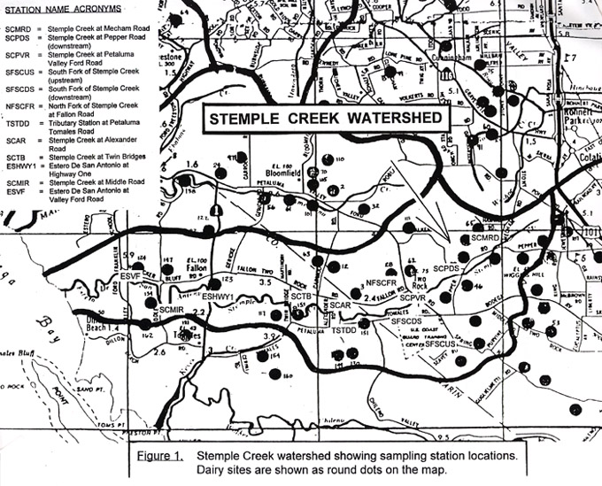
This map shows the sampling locations for water quality monitoring conducted from 1990-1994 by the North Coast Regional Water Quality Control Board in the Stemple Creek watershed. Image taken from CRWQCB, 1995
 Click on image to enlarge (169K).
To learn more about this topic click Info Links
To view additional information (data source, aquisition date etc.) about this page, click Metadata
| www.krisweb.com |