| Area |
Stemple Creek |
| Topic |
Tour: Stemple Creek Restoration and Habitat Maps |
 Click on image to enlarge (57K). Click here to display a larger version (276K).
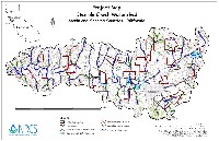
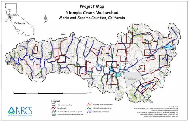
This is a map of the Stemple Creek watershed showing areas of restored and natural riparian vegetation, as well as potential riparian restoration areas. This image was created for the Stemple Creek Watershed Project, Draft Watershed Project Plan and Environmental Assessment (NRCS, 2002), which was sponsored by the Marin and Southern Sonoma County Resource Conservation Districts and assisted by the Natural Resources Conservation Service.
 Click on image to enlarge (140K). Click here to display a larger version (918K).
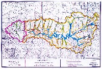
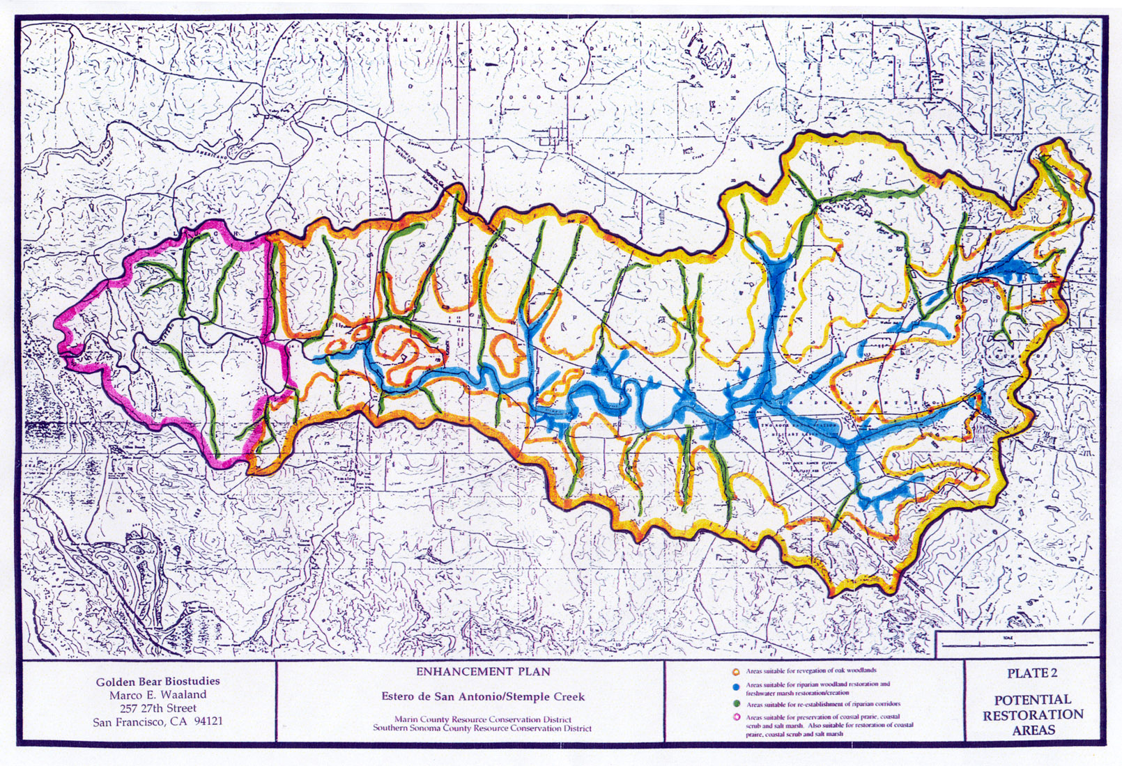
This map shows potential restoration areas in the Stemple Creek watershed. The image was created for the Stemple Creek/Estero de San Antonio Watershed Enhancement Plan (PCI, 1994), which was prepared for the Marin and Southern Sonoma County Resource Conservation Districts by Prunuske Chatham, Inc.
 Click on image to enlarge (140K). Click here to display a larger version (912K).
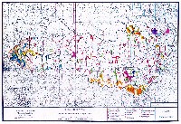
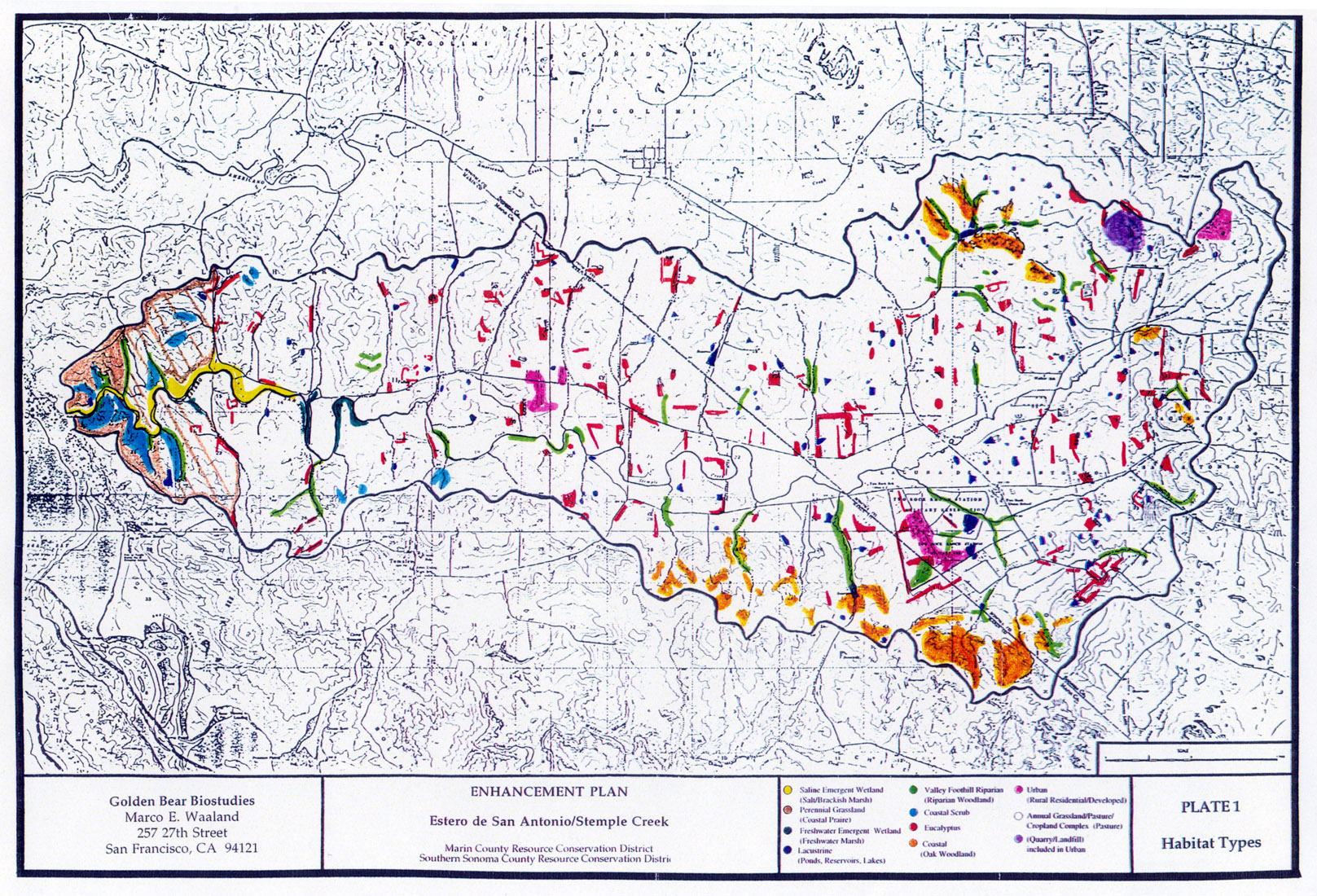
This map shows habitat types in the Stemple Creek watershed. The image was created for the Stemple Creek/Estero de San Antonio Watershed Enhancement Plan (PCI, 1994), which was prepared for the Marin and Southern Sonoma County Resource Conservation Districts by Prunuske Chatham, Inc.
 Click on image to enlarge (102K).
This map of the Estero de San Antonio (Stemple Creek estuary) shows that the water body was originally much larger prior to agricultural development which accelerated erosion and increased sediment delivery to the estuary. The sedimentation subsequently caused a reduction in the tidal prism, and therefore a reduction in the scouring ability of the currents and narrowing and shallowing of the channel entrance. The first closing of the estuary was thought to have occurred late in the 19th century. The map was prepared by Philip Williams and Associates for the Marin Resource Conservation District (PWA, 1993).
To learn more about this topic click Info Links
To view additional information (data source, aquisition date etc.) about this page, click Metadata

 Click on image to enlarge (57K). Click here to display a larger version (276K).
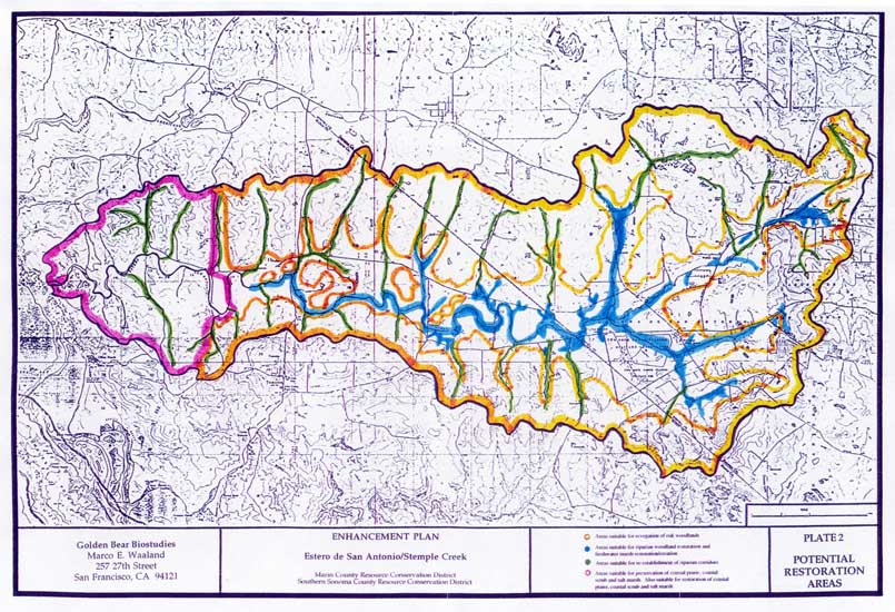 Click on image to enlarge (140K). Click here to display a larger version (918K).
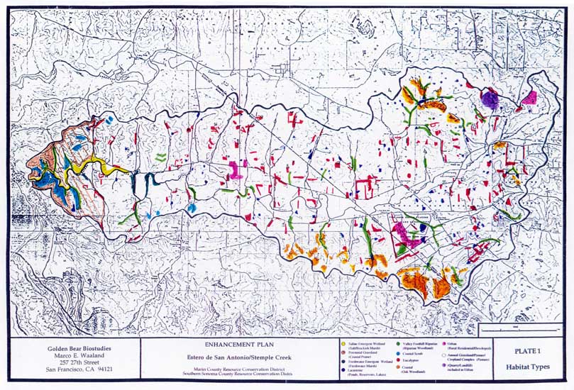 Click on image to enlarge (140K). Click here to display a larger version (912K).
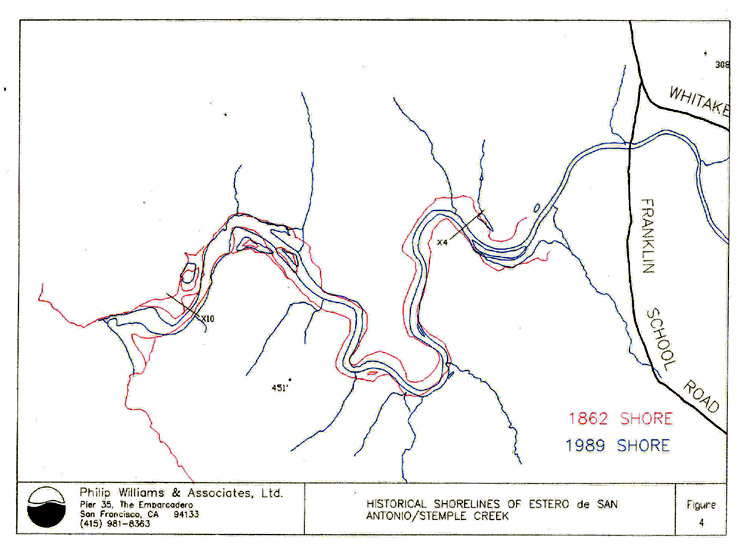 Click on image to enlarge (102K).
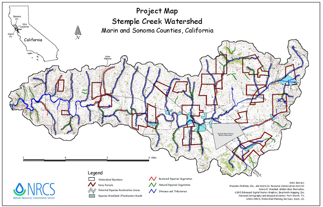