
| Area | S Marin/Redwood Creek |
| Topic | Fish: Redwood Creek 1983 Electrofishing Catch |
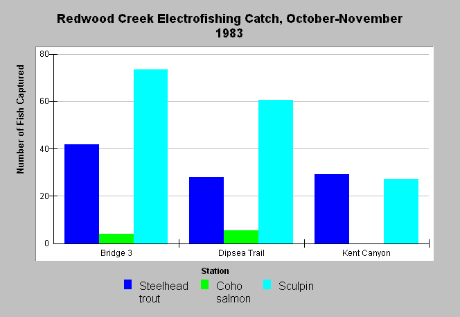
| Caption: This graph shows results from an electrofishing survey in Redwood Creek from October-November 1983. All stations were 100 feet long, with Station 1 about 100 feet above Bridge 3 in Muir Woods, Station 2 just below Dipsea Trail bridge in Muir Woods, and Station 3 just above the confluence of Kent Canyon Creek in Mt. Tamalpais State Park. At each station, stream flow was estimated at 0.4, 0.5, and 0.7 cfs and water temperatures at 63, 64, and 60°F, respectively. A two-pass removal method was used during electrofishing. Data were collected by the California Department of Fish and Game. | |
 |
To learn more about this topic click Info Links .
To view additional information (data source, aquisition date etc.) about this page, click Metadata .
To view the table with the chart's data, click Chart Table web page.
To download the table with the chart's data, click fish_redwood_efish_cdfg_1983.xls.db (size 4,096 bytes) .
| www.krisweb.com |