
| Area | S Marin/Redwood Creek |
| Topic | Flow: Redwood Creek Daily Flow at Highway 1 Bridge 1998-2001 |
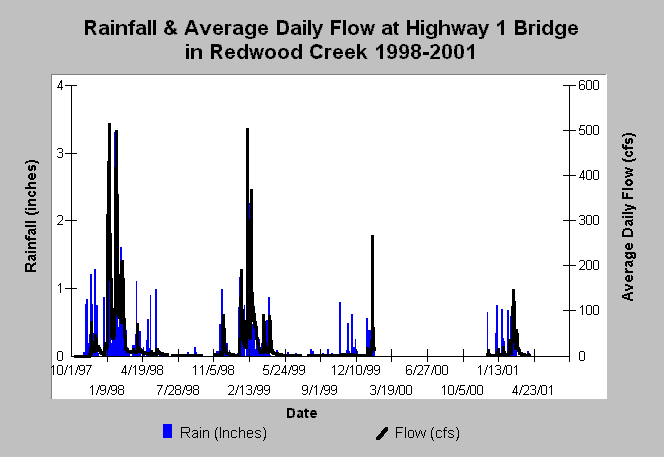
| Caption: This chart displays rainfall and average daily streamflows by water year for Redwood Creek at the Highway 1 bridge beginning with water year 1998 (10/1/97) and ending in June 2001. Note that early storms do not generate the same peak flows as later storms because the ground is not yet saturated. The water year runs from October 1 to September 30. Data were collected by the Golden Gate National Recreation Area and Point Reyes National Seashore. | |
 |
To learn more about this topic click Info Links .
To view additional information (data source, aquisition date etc.) about this page, click Metadata .
To view the table with the chart's data, click Chart Table web page.
To download the table with the chart's data, click flowraindaily_redwood_nps_1997_2001.xls.db (size 49,152 bytes) .
| www.krisweb.com |