
| Area | S Marin/Redwood Creek |
| Topic | Flow: Redwood Creek Instantaneous per Site 1993 |
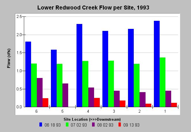
| Caption: Flow measurements taken at several stations along Redwood Creek in 1993 indicate an affect of well pumping. Flows accumulates in a downstream direction in June but decreases, likely due to surface and ground water extraction, in August and September 1993. Site 6 was below Muir Woods, Site 5 was above the Muir Beach Community Services District (MBCSD) well, Site 4 was above the Banducci wells, Site 3 was between the Banducci wells, Site 2 was above Highway One, and Site 1 was at Pacific Way. Data were collected by Philip Williams & Associates, Ltd. for the Golden Gate National Recreation Area. See caption of Chart Table for more detailed description of sites. | |
 |
To learn more about this topic click Info Links .
To view additional information (data source, aquisition date etc.) about this page, click Metadata .
To view the table with the chart's data, click Chart Table web page.
To download the table with the chart's data, click flow_redwood_pwa_1993_1994.dbf (size 1,078 bytes) .
| www.krisweb.com |