
| Area | S Marin/Redwood Creek |
| Topic | Flow: Redwood Creek Instantaneous per Site 1994 |
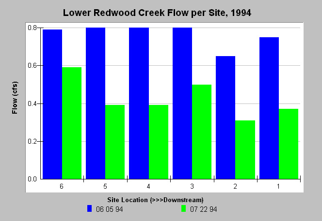
| Caption: Flow measurements taken at several stations along Redwood Creek in 1994 indicate an affect from well pumping. The decrease in flow moving downstream was more pronounced on July 22 than on June 5. Site 6 was below Muir Woods, Site 5 was above the Muir Beach Community Services District (MBCSD) well, Site 4 was above the Banducci wells, Site 3 was between the Banducci wells, Site 2 was above Highway One, and Site 1 was at Pacific Way. Data were collected by Philip Williams & Associates, Ltd. for the Golden Gate National Recreation Area. See caption of Chart Table for more detailed description of sites. | |
 |
To learn more about this topic click Info Links .
To view additional information (data source, aquisition date etc.) about this page, click Metadata .
To view the table with the chart's data, click Chart Table web page.
To download the table with the chart's data, click flow_redwood_pwa_1993_1994.dbf (size 1,078 bytes) .
| www.krisweb.com |