
| Area | S Marin/Redwood Creek |
| Topic | Flow: Redwood Creek Maximum Peak Flows 1962-1970 |
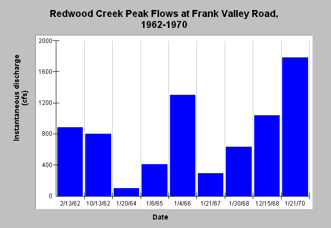
| Caption: This chart shows instantaneous flow (cfs) of Redwood Creek at Frank Valley Road during selected storm peaks from 1962-1970. The data prior to 1967 are not extracted from continuous flow records from a gauge but rather taken by field personnel during storms. The highest flow measured was on January 21, 1970. The January 6, 1965 represents flows about two weeks after the regionally devastating 1964 flood. Data were collected by U.S. Geological Survey. See Info Links for more information. | |
 |
To learn more about this topic click Info Links .
To view additional information (data source, aquisition date etc.) about this page, click Metadata .
To view the table with the chart's data, click Chart Table web page.
To download the table with the chart's data, click flow_redwood_peak_usgs_1962_1970.xls.db (size 4,096 bytes) .
| www.krisweb.com |