
| Area | S Marin/Redwood Creek |
| Topic | Habitat: Bolinas Lagoon Trib Distance of Bank Stabilization 1999 |
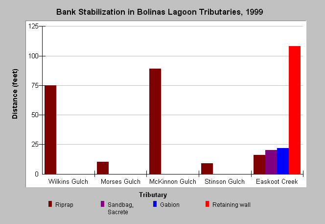
| Caption: All tributaries along the east-side of Bolinas Lagoon surveyed in 1999 had banks stabilized through human modifications. The graph shows the total distances of various stabilization techniques for each tributary. These data were collected by the Golden Gate National Recreation Area in 1999. See Info Links for more information. | |
 |
To learn more about this topic click Info Links .
To view additional information (data source, aquisition date etc.) about this page, click Metadata .
To view the table with the chart's data, click Chart Table web page.
To download the table with the chart's data, click bank_stabdist_bolinas_goga_2000.dbf (size 574 bytes) .
| www.krisweb.com |