
| Area | S Marin/Redwood Creek |
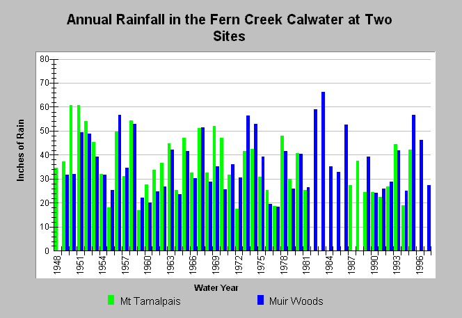
| Topic | Climate: Southern Marin Coast South Annual Rainfall 1948-2000 |
| Caption: This chart shows annual rainfall totals recorded at California Department of Water Resources (CDWR) gauging stations within the Fern Creek Calwater between 1948 and 2000. The CDWR gauging stations are as follows: Mt. Tamalpias 2SW (DWR # E20 5995 00) and Muir Woods (DWR # E20 6027 00). Blank years indicate no data. See Map for gauge locations and Info Links for more information. | |
 |
To learn more about this topic click Info Links .
To view additional information (data source, aquisition date etc.) about this page, click Metadata .
To view the table with the chart's data, click Chart Table web page.
To download the table with the chart's data, click rain_annual_southmarincoast_south.dbf (size 2,335 bytes) .
| www.krisweb.com |