
| Area | S Marin/Redwood Creek |
| Topic | Habitat: Redwood Creek Wetted 2nd Channel/Backwater Pools 1995 |
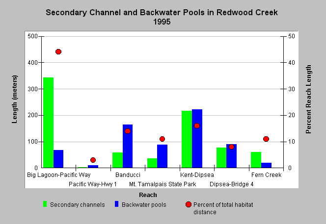
| Caption: This graph shows the relative percent lengths of wetted secondary channels and backwater pool habitats measured in six reaches along mainstem Redwood Creek and one reach in tributary, Fern Creek, from 1995. These data were collected in seven reaches by the Golden Gate National Recreation Area (GOGA). The overall percent reach length of these types of habitat is shown with red markers and a second axis. Big Lagoon-Pacific Way had the greatest amount of secondary channels. GOGA notes in this area that during large storm events, water overflows from the main channel into an adjacent borrow pit and pasture. GOGA also states, while these areas have been modified by human activities, their presence does provide refugia for fish from high-velocity flows in the main channel. | |
 |
To learn more about this topic click Info Links .
To view additional information (data source, aquisition date etc.) about this page, click Metadata .
To view the table with the chart's data, click Chart Table web page.
To download the table with the chart's data, click hab_redwood_otherhab_1995.dbf (size 1,819 bytes) .
| www.krisweb.com |