
| Area | S Marin/Redwood Creek |
| Topic | Stream Channel: Longitudinal Profile Redwood Cr Hwy 1 to MWRB 1999 |
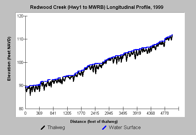
| Caption: The chart shows the depth of the thalweg (deepest portion of the stream) and the water surface in Redwood Creek from the Highway 1 Bridge to about 200 feet upstream of Muir Woods Road Bridge in 1999. Data were collected by Golden Gate National Recreation Area. The elevation is relative and survey markers are used so that locations can be monitored for change in the thalweg depth profile and pool spacing. This information is particularly useful when a data set spanning several years is available. | |
 |
To learn more about this topic click Info Links .
To view additional information (data source, aquisition date etc.) about this page, click Metadata .
To view the table with the chart's data, click Chart Table web page.
To download the table with the chart's data, click xsect_longprof_redwood_1999.xls.db (size 53,248 bytes) .
| www.krisweb.com |