
| Area | S Marin/Redwood Creek |
| Topic | WQ: Specific Conductance in Laurel Creek 2000 |
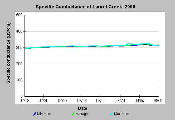
| Caption: This chart shows minimum, average and maximum specific conductance in Laurel Creek (near its mouth) during the year 2000. See Map for sampling location and Info Links for more information. Data were collected by the Golden Gate National Recreation Area. | |
 |
To learn more about this topic click Info Links .
To view additional information (data source, aquisition date etc.) about this page, click Metadata .
To view the table with the chart's data, click Chart Table web page.
To download the table with the chart's data, click wq_goga_2000chart.db (size 34,816 bytes) .
To view the table with the chart's source data, click Source Table web page.
To download the table with the chart's source data, click wq_goga_2000source.dbf (size 1,131,392 bytes)
| www.krisweb.com |