
| Area | S Marin/Redwood Creek |
| Topic | WQ: Total Suspended Solids in Redwood Creek 1993 |
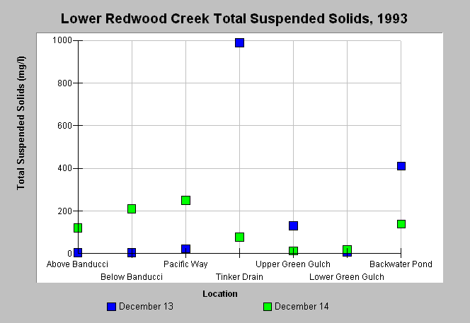
| Caption: This graph shows total suspended solid concentrations measured in Redwood Creek during 1993. The December 13th and 14th values represent one-time storm measurements. Stations were selected in order to gauge effects of land use on water quality. Data were collected by Philip Williams and Associates for the California Department of Transportation, District IV and the Golden Gate National Recreation Area. See Picture for a map of the sampling locations. | |
 |
To learn more about this topic click Info Links .
To view additional information (data source, aquisition date etc.) about this page, click Metadata .
To view the table with the chart's data, click Chart Table web page.
To download the table with the chart's data, click wq_redwood_sumpwa_1993.dbf (size 2,555 bytes) .
To view the table with the chart's source data, click Source Table web page.
To download the table with the chart's source data, click wq_redwood_pwa_1993.dbf (size 4,978 bytes)
| www.krisweb.com |