
| Area | S Marin/Redwood Creek |
| Topic | Habitat: Redwood Creek Habitat Types Volume 1995 |
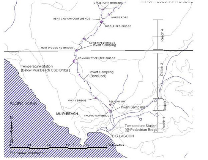
This map shows Reaches 1-4 (out of six, plus tributary Fern Creek) where Golden Gate National Recreation Area staff conducted a stream habitat and benthic macroinvertebrate inventory of Redwood Creek in 1995. See Picture #2 for Reaches 5-6.
This map shows Reaches 5 and 6 (plus tributary Fern Creek) where Golden Gate National Recreation Area staff conducted a stream habitat and benthic macroinvertebrate inventory of Redwood Creek in 1995. See Picture #2 for Reaches 1-4.
This graph shows habitat volume per unit of stream length measured in six reaches of mainstem Redwood Creek and one reach of tributary Fern Creek in the summer of 1995. data were collected by the Golden Gate National Recreation Area. Reach 1 had the greatest amount of habitat volume per stream distance. GOGA notes that this area is dominated by large pools. This graph shows data from the same survey as the Chart and Chart Table for this topic, but it a more detailed form. Only reach summary data, not raw data, were obtained for KRIS.
 Click on image to enlarge (114K).
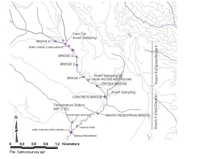 Click on image to enlarge (58K).
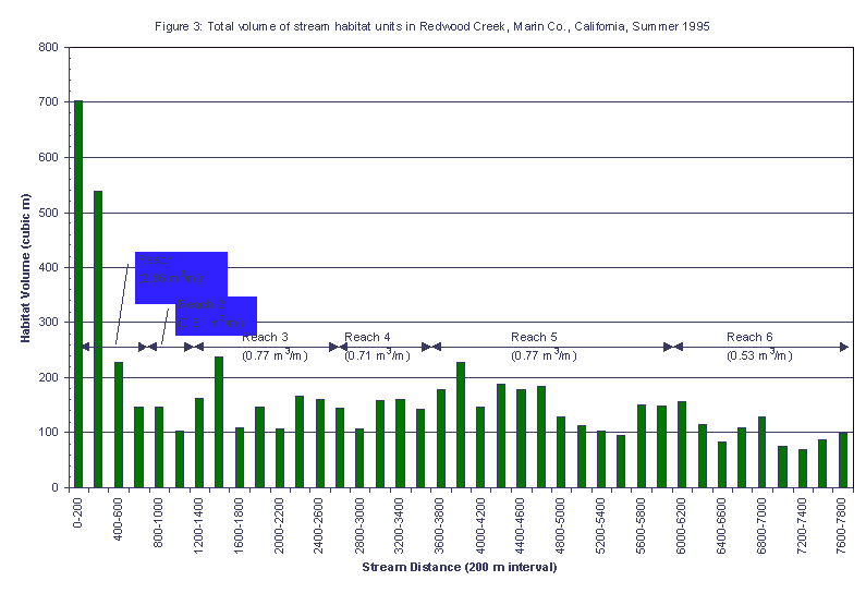 Click on image to enlarge (13K).
To learn more about this topic click Info Links
To view additional information (data source, aquisition date etc.) about this page, click Metadata
| www.krisweb.com |