| Area |
S Marin/Redwood Creek |
| Topic |
Tour: Historical Maps and Photos of Bolinas Lagoon |
 Click on image to enlarge (82K). Click here to display a larger version (207K).
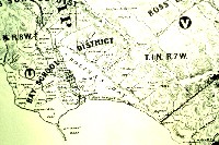
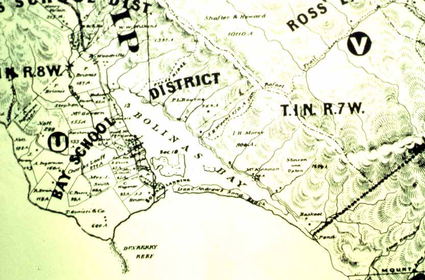
This is a Bay School District map, which shows Bolinas Lagoon, from 1873. Map provided by the Stinson Beach Historical Society.
 Click on image to enlarge (59K). Click here to display a larger version (292K).
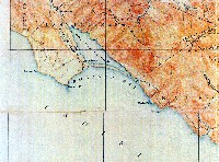
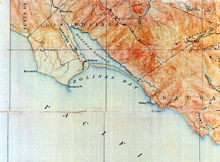
This is a section of the Tamalpais Sheet of the U.S. Geological Survey topographic map from 1897 and reprinted in 1907. Map provided by the Stinson Beach Historical Society.
 Click on image to enlarge (97K).
This picture shows a schooner entering Bolinas Lagoon. Boats of this size can no longer access the lagoon due to sedimentation. Photo taken in 1897 and provided courtesy of the Stinson Beach Historical Society.
 Click on image to enlarge (28K). Click here to display a larger version (179K).
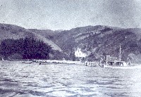
This picture shows a boat docked in Bolinas Lagoon. Photo taken in 1910 and provided courtesy of the Stinson Beach Historical Society.
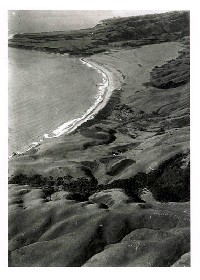 Click on image to enlarge (72K).
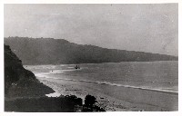
This picture shows the Bolinas Lagoon area, before major development of Stinson Beach and Seadrift. Photo taken in 1910 and provided courtesy of the Stinson Beach Historical Society.
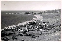 Click on image to enlarge (144K).
This picture shows Stinson Beach and Bolinas Lagoon, before major development of Seadrift. Note there are approximately three houses on the spit. Photo taken in 1953 and provided courtesy of the Stinson Beach Historical Society.
 Click on image to enlarge (39K). Click here to display a larger version (292K).
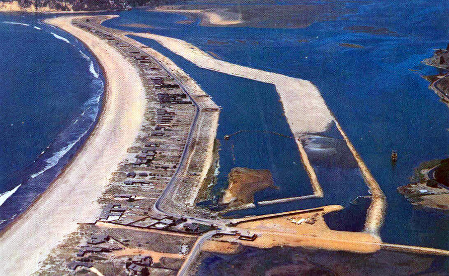
This picture shows the filling of the Dipsea part of Seadrift Lagoon. The water level was designed to be controlled for swimming and sailing. Photo taken circa 1955-58 and provided courtesy of the Stinson Beach Historical Society.
To learn more about this topic click Info Links
To view additional information (data source, aquisition date etc.) about this page, click Metadata

 Click on image to enlarge (82K). Click here to display a larger version (207K).
 Click on image to enlarge (59K). Click here to display a larger version (292K).
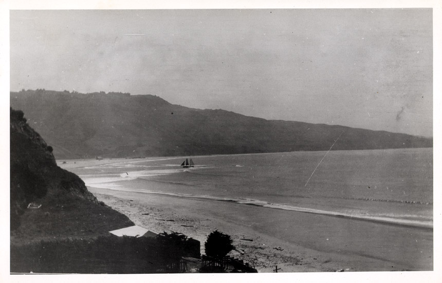 Click on image to enlarge (97K).
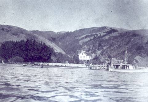 Click on image to enlarge (28K). Click here to display a larger version (179K).
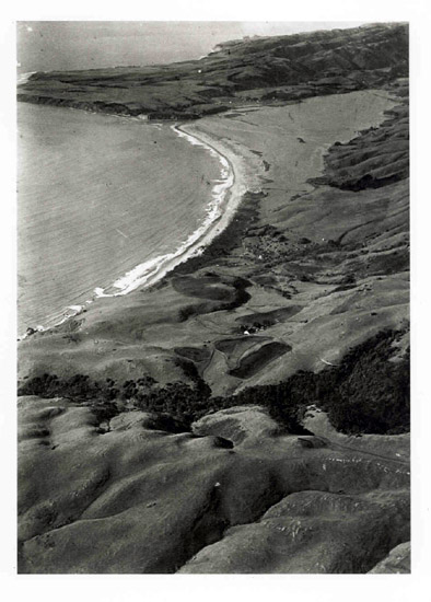 Click on image to enlarge (72K).
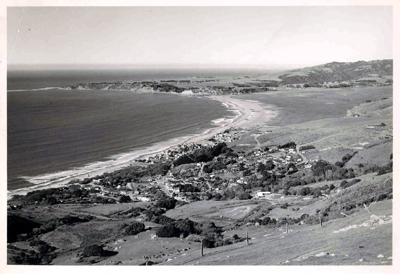 Click on image to enlarge (144K).
 Click on image to enlarge (39K). Click here to display a larger version (292K).
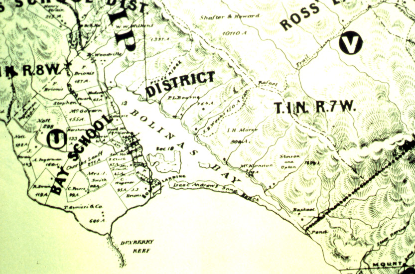