
| Area | S Marin/Redwood Creek |
| Topic | WQ: Fecal Coliform in Redwood Creek 1993 |
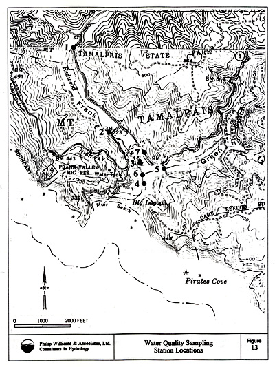
This map shows the locations of water quality sampling conducted in Redwood Creek during 1993. In reference to the associated Chart, Site 1 is Above Banducci, Site 2 is Below Banducci, Site 3 is Pacific Way, Site 4 is Backwater Pond, Site 5 is Upper Green Gulch, Site 6 is Lower Green Gulch, and Site 7 is Tinker Drain. Data collected by Philip Williams & Associates for the California Department of Transportation, District IV and the Golden Gate National Recreation Area.
 Click on image to enlarge (146K).
To learn more about this topic click Info Links
To view additional information (data source, aquisition date etc.) about this page, click Metadata
| www.krisweb.com |