| Area |
Salmon Creek |
| Topic |
Climate: Bodega Marine Lab Annual Rainfall 1968-1992 |
|
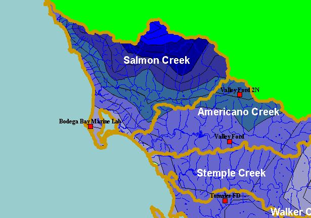
This is a map of rain gauges in the northern end of the KRIS West Marin-Sonoma project. Bodega Bay can be thought of as
representative of coastal rainfall, whereas interior gauges near mountains will have greater precipitation. Data are from California
Department of Water Resources (DWR). Displayed in the background are KRIS sub-basins and the annual rainfall model from
Oregon State University.
|
|
|
 |
 |
To view metadata about a map layer, click on a link in the table below.
