| Area |
Salmon Creek |
| Topic |
Tour: Fay Creek Easement Photo Points I 2001 |
 Click on image to enlarge (70K). Click here to display a larger version (523K).
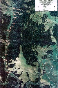
The aerial shows photo points for the Fay Creek riparian corridor easement held by the Bodega Land Trust and surveyed during August 2001. This photo was taken on April 13, 1999 and provided courtesy of the Bodega Land Trust.
 Click on image to enlarge (45K). Click here to display a larger version (289K).
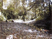
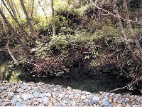
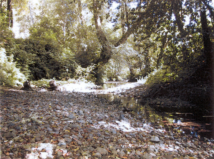
This photo was taken looking downstream from where the trail from the quarry meets Fay creek at Photo Point #5 in the previous aerial. The stream here is shown in a low gradient riffle and has gravel beds suitable for salmon and steelhead spawning and shade provided by a mature canopy of mostly hardwoods. An old quarry is nearby on the east side of Fitzpatrick Land. Photo taken on June 17, 2000 and provided by the Bodega Land Trust.
 Click on image to enlarge (46K). Click here to display a larger version (305K).
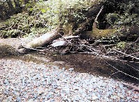
This photo was taken at Photo Point #12 in the previous aerial, from about 75 yards further north from Picture #1, looking downstream at the eroding roadbed. Seventy five yards further up Fay Creek, in another drainage, a gully is forming across the roadbed. One hundred yards further there is a larger drainage, with more open area and rushes. Next is an area with many bay trees and an understory of ferns. Photo taken on June 17, 2000 and provided by the Bodega Land Trust.
 Click on image to enlarge (42K). Click here to display a larger version (267K).
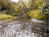
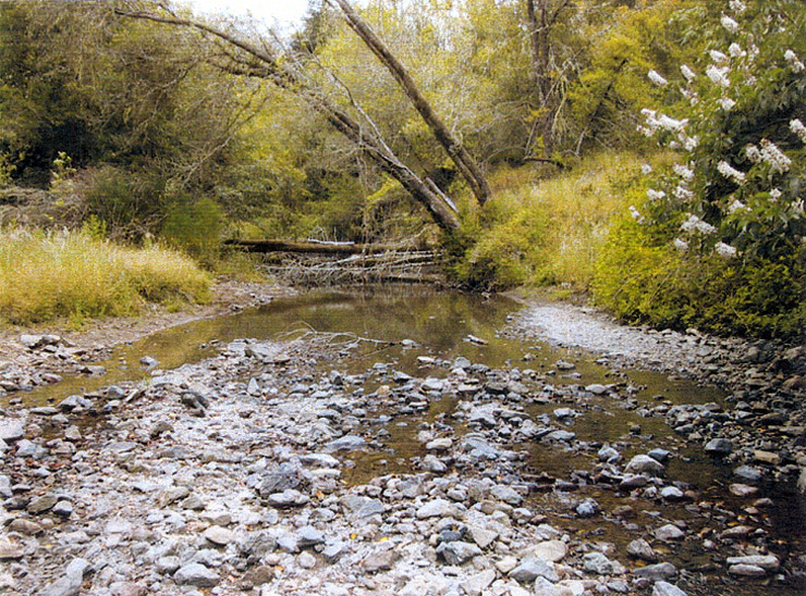
This photo shows Fay Creek from the middle of the creek looking upstream towards the northern boundary of the protected area at Photo Point #17 in the previous aerial. The creek is shown here with a broad flood plain in an unconfined reach (Rosgen C3 channel type). The foreground of the photo is a low gradient riffle flowing from a pool formed by downed hardwoods. Photo taken on June 17, 2000 and provided by the Bodega Land Trust.
 Click on image to enlarge (42K). Click here to display a larger version (248K).
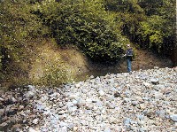
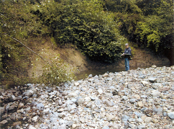
This picture shows a cutbank 50 yards downstream of the power lines on Fay Creek at Photo Point #18 in the previous aerial. The cutbank is 50 feet long and 15 feet high. An old cattle trail leads out of the creek onto the left bank just upstream of where the gully enters. Across from the gully, rock two feet in diameter has been placed to stabilize the toe of the right bank. Along this stretch of the creek, there are several small cutbanks, void of vegetation. Photo taken on June 17, 2000 and provided by the Bodega Land Trust.
 Click on image to enlarge (43K). Click here to display a larger version (267K).
This picture was taken at Photo Point #21, which is not shown in the previous aerial, looking downstream towards the Fay Creek bridge from about 50 yards north of the bridge. A floating gate is under the bridge to prevent cattle access from adjacent ownership. Fay Creek is shown here in a high gradient riffle which flows into a pool just downstream formed by the roots of the mature hardwood tree. Conifers form an overstory to the canopy here. Photo taken on June 17, 2000 and provided by the Bodega Land Trust.
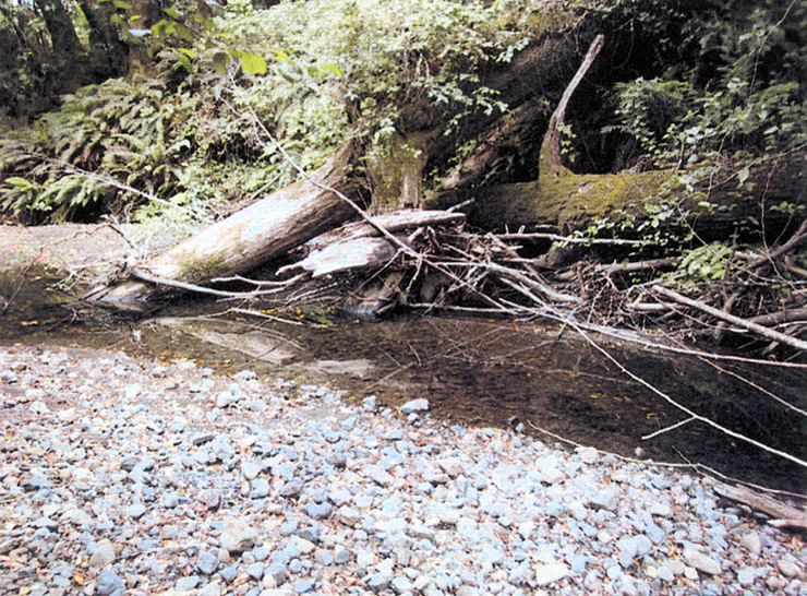
 Click on image to enlarge (44K). Click here to display a larger version (244K).
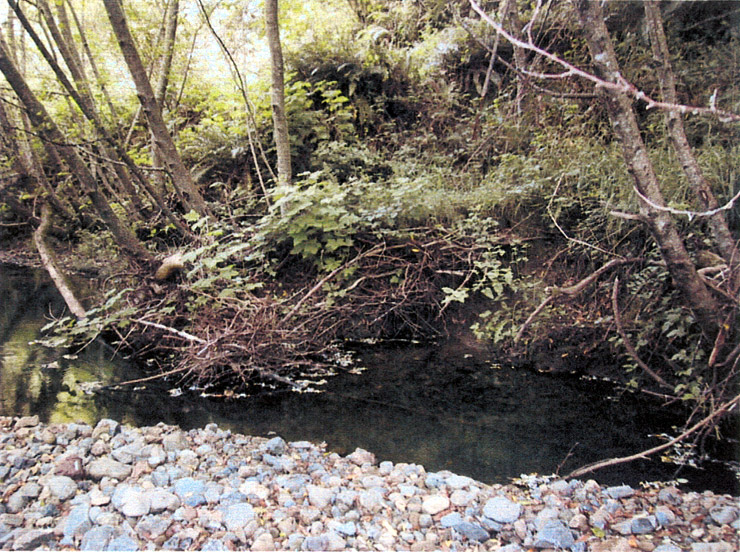
This picture was taken at Photo Point #23, which is not shown in the previous aerial, and shows a pool with complex structure: large woody debris, small woody debris, and a root wad. This photo was taken about 50 yards south of the Fay Creek Bridge. Photo taken on June 17, 2000 and provided by the Bodega Land Trust.
 Click on image to enlarge (46K). Click here to display a larger version (241K).
This picture was taken at Photo Point #24 in the previous aerial and shows Fay Creek on the Moon Reserve in a pool formed by large woody debris and cover from small woody debris, which adds complexity. Photo taken on June 17, 2000 and provided by the Bodega Land Trust.
To learn more about this topic click Info Links
To view additional information (data source, aquisition date etc.) about this page, click Metadata

 Click on image to enlarge (70K). Click here to display a larger version (523K).
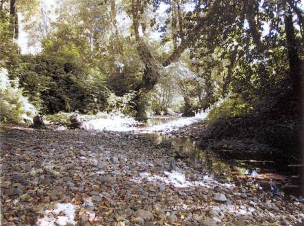 Click on image to enlarge (45K). Click here to display a larger version (289K).
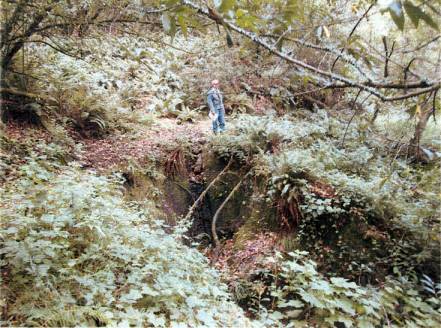 Click on image to enlarge (46K). Click here to display a larger version (305K).
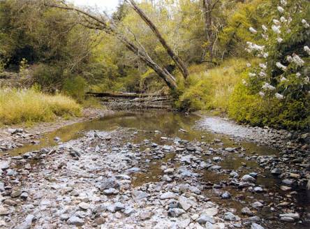 Click on image to enlarge (42K). Click here to display a larger version (267K).
 Click on image to enlarge (42K). Click here to display a larger version (248K).
 Click on image to enlarge (43K). Click here to display a larger version (267K).
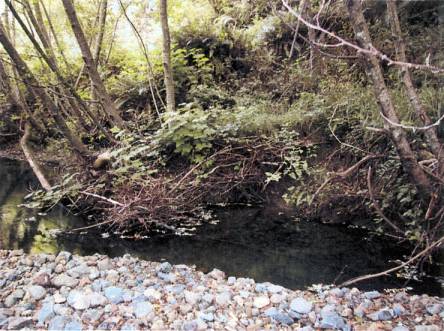 Click on image to enlarge (44K). Click here to display a larger version (244K).
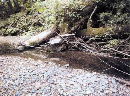 Click on image to enlarge (46K). Click here to display a larger version (241K).
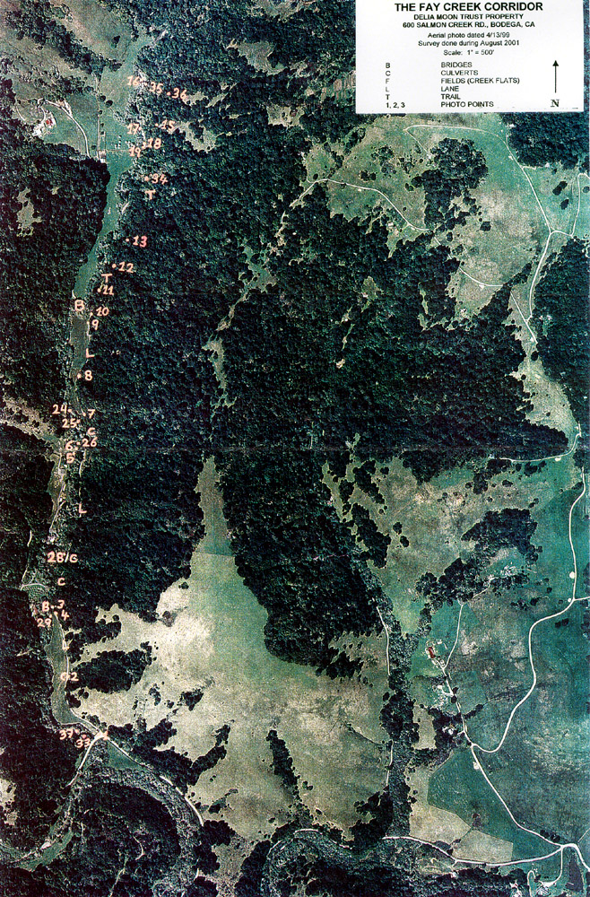