| Area |
Salmon Creek |
| Topic |
Tour: Fay Creek Easement Photo Points II 2001 |
 Click on image to enlarge (45K). Click here to display a larger version (265K).
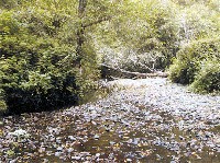
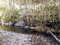
This photo was taken at Photo Point #25 on the aerial in the previous topic. Fay Creek on the Moon Reserve spills from a low gradient riffle into a lateral scour pool with an undercut bank formed by roots and overhanging terrestrial vegetation. The undercut bank and cover provide good shelter for juvenile steelhead and protection from avian predators like king fishers. Photo taken on June 17, 2000 and provided by the Bodega Land Trust.
 Click on image to enlarge (45K). Click here to display a larger version (249K).
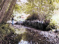
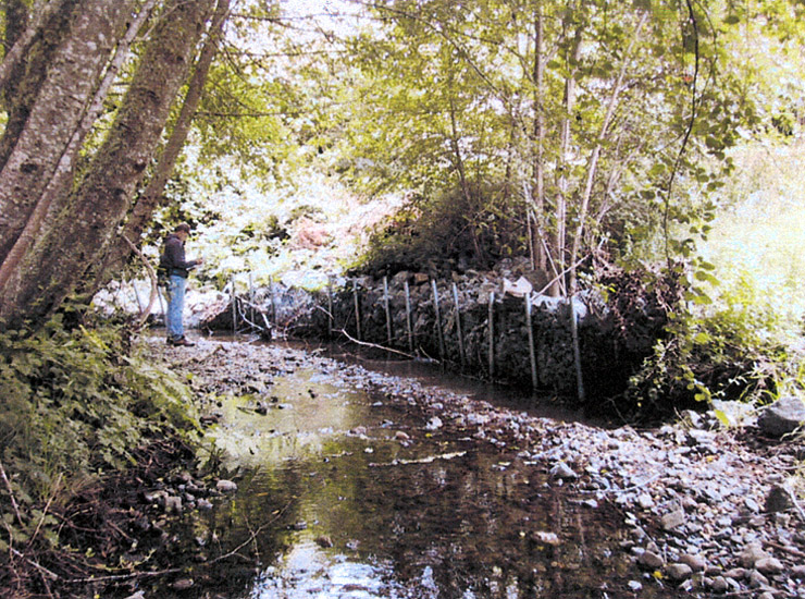
Stream bank stabilization structure on Fay Creek made of steel posts, wire, and rock, on right bank about 10 yards north of the road repair. There is no photo point associated with this picture. Photo taken on June 17, 2000 and provided by the Bodega Land Trust.
 Click on image to enlarge (40K). Click here to display a larger version (223K).
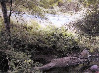
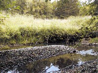
This photo was taken at Photo Point #28 on the aerial in the previous topic. Fitzpatrick Lane runs parallel to Fay Creek in this photo, which was taken about 10 yards below the bank stabilization in Picture #2. Note pillow of fine sediment upstream of boulder near far bank. Photo taken on June 17, 2000 and provided by the Bodega Land Trust.
 Click on image to enlarge (42K). Click here to display a larger version (263K).
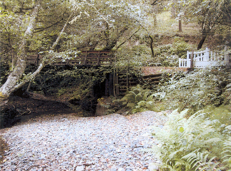
This photo was taken at Photo Point #29 on the aerial in the previous topic, looking upstream at the Deer Haven Bridge and gate from the middle of the Fay Creek about 20 yards downstream from the bridge. An old roadbed follows the right creek bank from this point downstream. Photo taken on June 17, 2000 and provided by the Bodega Land Trust.
 Click on image to enlarge (44K). Click here to display a larger version (275K).
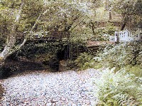
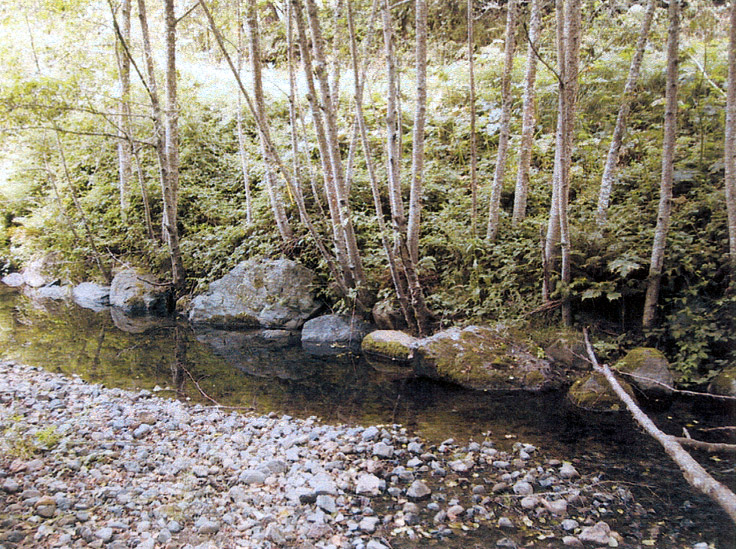
This photo shows a small pool on Fay Creek formed around rip rap boulders placed to stabilize the bank. Alder trees have grown in the rockwork helping to anchor it. The alders also provide shade to maintain cool water temperatures and add nutrients to the stream with their leaf fall. There is no photo point associated with this picture. Photo taken on June 17, 2000 and provided by the Bodega Land Trust.
 Click on image to enlarge (39K). Click here to display a larger version (252K).
This photo shows a repaired stream bank where bio-engineering was employed at Photo Point #31. This photo point is not labeled on the aerial in the previous topic. Live willow cuttings were used to build a protection barrier for the far bank and the willows have sprouted. This project is part of a larger Fay Creek Reforestation Project. The particle size distribution of the gravel bar in the middle of the creek appears small. Photo taken on June 17, 2000 and provided by the Bodega Land Trust.
 Click on image to enlarge (46K). Click here to display a larger version (248K).
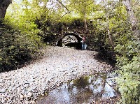
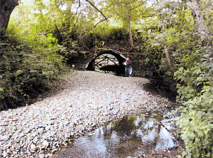
This photo was taken at Photo Point #33 on the aerial in the previous topic, looking downstream on Fay Creek at the culvert under the Salmon Creek Road from about 50 yards upstream. The culvert is approximately 40 feet long. The edges of the culvert have been damaged during high stream flows and bedload appears to be accreting upstream. Photo taken on June 17, 2000 and provided by the Bodega Land Trust.
 Click on image to enlarge (155K).
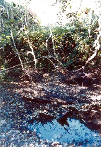
This photo was taken at Photo Point #37 on the aerial in the previous topic and shows the edge of a pool in Fay Creek with the far bank covered with blackberries. The pool had steelhead fingerlings and a shrimp in late August 2001. Photo provided courtesy of the Bodega Land Trust. Photo taken on August 23, 2001 and provided by the Bodega Land Trust.
To learn more about this topic click Info Links
To view additional information (data source, aquisition date etc.) about this page, click Metadata

 Click on image to enlarge (45K). Click here to display a larger version (265K).
 Click on image to enlarge (45K). Click here to display a larger version (249K).
 Click on image to enlarge (40K). Click here to display a larger version (223K).
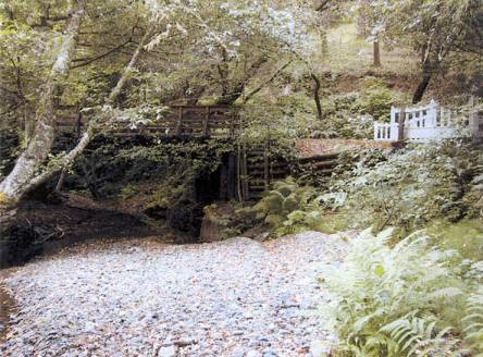 Click on image to enlarge (42K). Click here to display a larger version (263K).
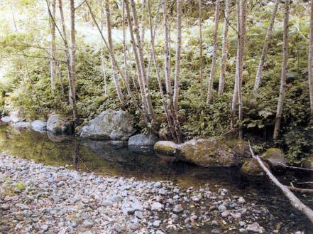 Click on image to enlarge (44K). Click here to display a larger version (275K).
 Click on image to enlarge (39K). Click here to display a larger version (252K).
 Click on image to enlarge (46K). Click here to display a larger version (248K).
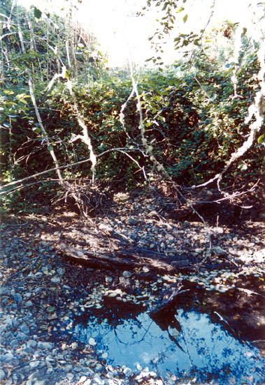 Click on image to enlarge (155K).
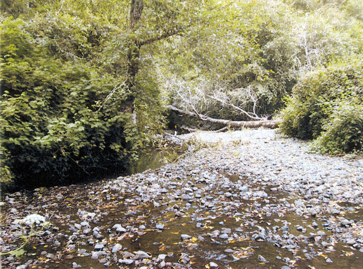