| Area |
Salmon Creek |
| Topic |
Tour: Finley Creek Easement Photo Points 2001 |
 Click on image to enlarge (91K). Click here to display a larger version (538K).
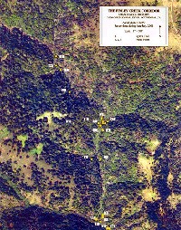
The aerial shows photo points for the Finley Creek corridor riparian corridor easement held by the Bodega Land Trust. Finley Creek is a tributary of Salmon Creek. The photo was taken on April 13, 1999 and provided courtesy of the Bodega Land Trust.
 Click on image to enlarge (37K). Click here to display a larger version (217K).
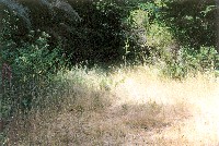
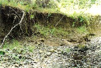
This picture was taken looking south down from the top of the fourth logging road at Photo Point #2 in the previous aerial. The road runs along the creek. This area is at the north end of the open space where Kyle's Trail crosses the road. Photo taken during summer 2001 and provided courtesy of the Bodega Land Trust.
 Click on image to enlarge (44K). Click here to display a larger version (272K).
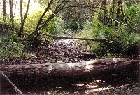
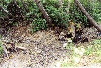
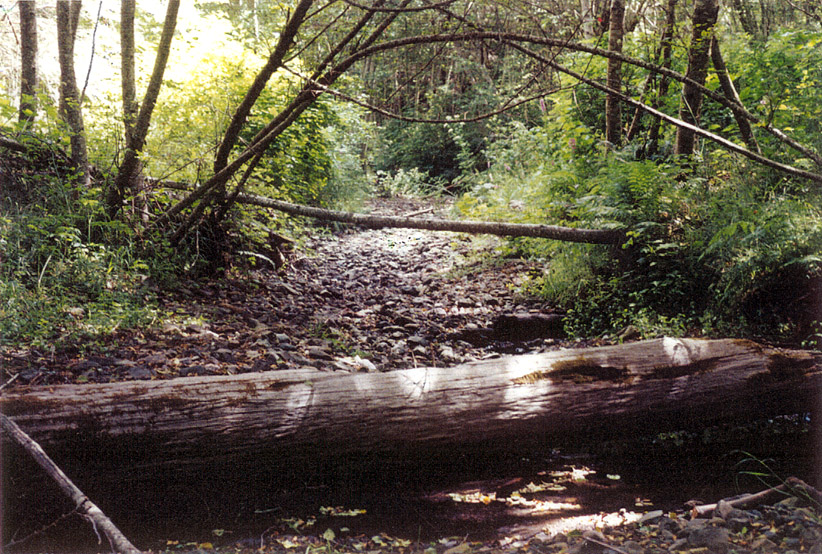
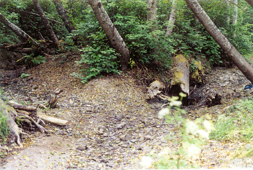
This picture was taken at Photo Point #4 in the previous aerial. About 125 feet downstream from the trailhead a large log crosses the creek. A good nursery pool is downcut on the down side. This is typical of several sites on the creek. Taken about 10 feet downstream from the log. Photo taken during summer 2001 and provided courtesy of the Bodega Land Trust.
 Click on image to enlarge (51K). Click here to display a larger version (288K).
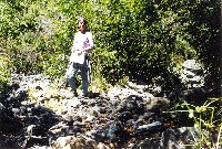
This picture was taken at Photo Point #5 in the previous aerial. About 750 feet further down stream a major side creek comes in from the west down a wide draw. It cuts the old logging road visible on the right; from the east bank of Finley Creek. Photo taken during summer 2001 and provided courtesy of the Bodega Land Trust.
 Click on image to enlarge (50K). Click here to display a larger version (293K).
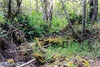
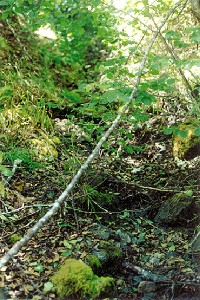
This picture was taken at Photo Point #8 in the previous aerial. About 125 feet upstream from the southeast corner of the corridor the creek is undercutting the old logging road. Taken from the east bank of Finley Creek. Photo taken during summer 2001 and provided courtesy of the Bodega Land Trust.
 Click on image to enlarge (45K). Click here to display a larger version (266K).
This picture was taken at Photo Point #10 in the previous aerial. Confluence of a large creek (southern boundary) and Finley Creek from Finley's east bank, showing the approximate location of the southeast corner of the corridor. Photo taken during summer 2001 and provided courtesy of the Bodega Land Trust.
 Click on image to enlarge (57K). Click here to display a larger version (348K).
This picture was taken at Photo Point #13 in the previous aerial. A side creek comes down a steep canyon from the west joining Finley Creek about 125 feet south of the northeast corner of the corridor. Finley continues to the right with the corner in the distance. Taken about 15 feet downstream from the middle of the creek. Photo taken during summer 2001 and provided courtesy of the Bodega Land Trust.
 Click on image to enlarge (140K).
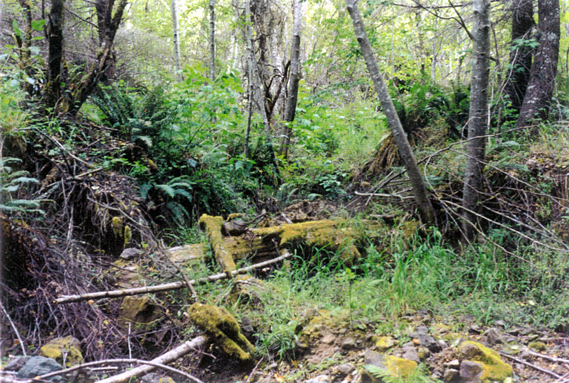
This picture was taken at Photo Point #15 in the previous aerial. About 250 feet further down a side creek comes down a wide draw. Taken from Finley Creek looking up the side creek. Photo taken during summer 2001 and provided courtesy of the Bodega Land Trust.
To learn more about this topic click Info Links
To view additional information (data source, aquisition date etc.) about this page, click Metadata

 Click on image to enlarge (91K). Click here to display a larger version (538K).
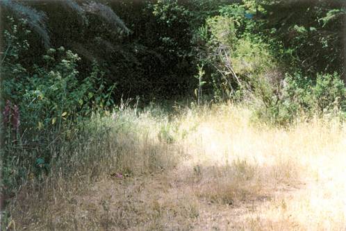 Click on image to enlarge (37K). Click here to display a larger version (217K).
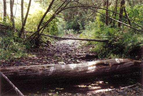 Click on image to enlarge (44K). Click here to display a larger version (272K).
 Click on image to enlarge (51K). Click here to display a larger version (288K).
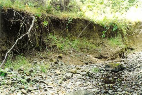 Click on image to enlarge (50K). Click here to display a larger version (293K).
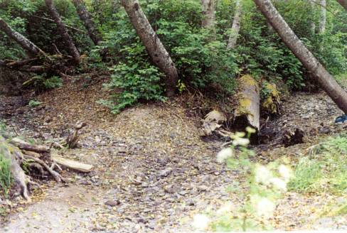 Click on image to enlarge (45K). Click here to display a larger version (266K).
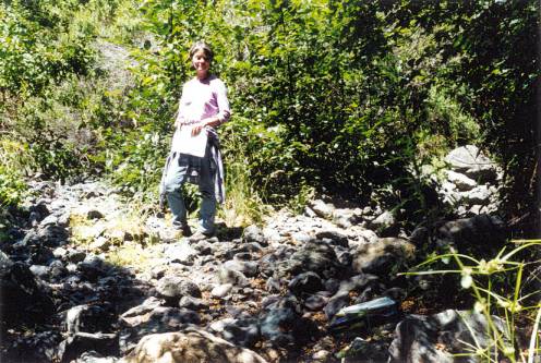 Click on image to enlarge (57K). Click here to display a larger version (348K).
 Click on image to enlarge (140K).
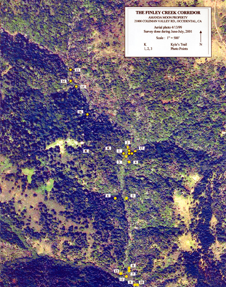