
| Area | Tomales Bay |
| Topic | Climate: Tomales Bay Basin Annual Rainfall 1926-1987 |
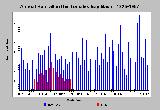
| Caption: This chart shows annual rainfall totals recorded at California Department of Water Resources (CDWR) gauging stations within the Tomales Bay Sub-Basin between 1926 and 1987. The CDWR gauging stations are as follows: Inverness (DWR # E10 4277 00) and Shilo (DWR # E30 8142 48). Blank years indicate no data. See Map for gauge locations and Info Links for more information. | |
 |
To learn more about this topic click Info Links .
To view additional information (data source, aquisition date etc.) about this page, click Metadata .
To view the table with the chart's data, click Chart Table web page.
To download the table with the chart's data, click rain_annual_tomalesbay.dbf (size 1,922 bytes) .
| www.krisweb.com |