| Area |
Tomales Bay |
| Topic |
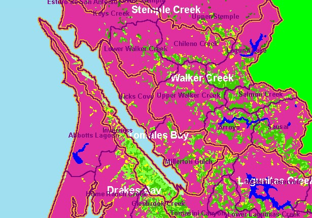
Land Cover: USFS Veg Size in Tomales Bay Sub-basin 1994 |
|
This is the 1994 USFS Landsat vegetation and tree size map for the Tomales Bay sub-basin. The large areas of Non-Forest in the
east and near the outlet of the bay on the west are grassy coastal plains and pasture. Coniferous forest and mixed forest dominate
the parts of the watershed west of the bay where there are rolling hills. The vegetation classification is accurate at a one-hectare
scale (approximately 11 pixels) and is suitable for stand classification. Data provided by the U.S. Forest Service Spatial Analysis
Lab in Sacramento, CA. Scale = 1:193,125 .
|
|
|
 |
 |
To view metadata about a map layer, click on a link in the table below.
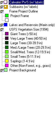
| Name of Layer in Map Legend | Metadata File Name |
|---|
| Calwater PWS (w/ labels) | calw22.shp.txt |
| Subbasins (w/ labels) | subbasins.shp.txt |
| Frame Project Outline | Unavailable |
| Lakes and Reservoirs (Marin only) | Unavailable |
| USFS Riparian Veg Size (1994) | vegsizebuf.tif.txt |
| USFS Vegetation Size (1994) | vegsize.tif.txt |
| Topo Map, North (1:24k scale) | Unavailable |
| Topo Map, South (1:24k scale) | Unavailable |
| Project Background | Unavailable |
