
| Area | Walker Creek |
| Topic | Sediment: Walker Creek Erosion Priorities by Sub-Watershed 2001 |
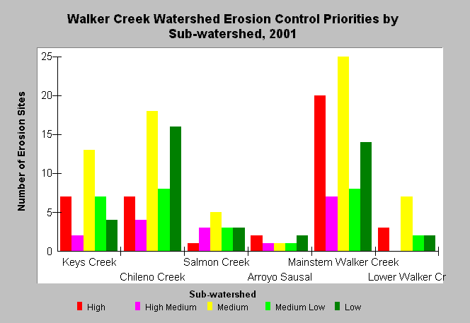
| Caption: The graph shows the number of erosions sites at each priority level in the sub-watersheds of Walker Creek. These data were produced as part of an erosion inventory conducted by Prunuske Chatham Inc. for the Marin Resource Conservation District in 2001. The survey identified 196 sites throughout the Walker Creek watershed, downstream of Soulajule Dam and Laguna Lake, where private landowners granted permission. Therefore, note that figures do not represent all erosion sites within the watershed, but those where investigation occurred. See Picture for a map of the erosion sites and Info Links for more information. | |
 |
To learn more about this topic click Info Links .
To view additional information (data source, aquisition date etc.) about this page, click Metadata .
To view the table with the chart's data, click Chart Table web page.
To download the table with the chart's data, click sediment_walker_erosiontpriority_2001.dbf (size 934 bytes) .
| www.krisweb.com |