| Area |
Walker Creek |
| Topic |
Land Cover: USFS Veg Size in Walker Creek Sub-basin 1994 |
|
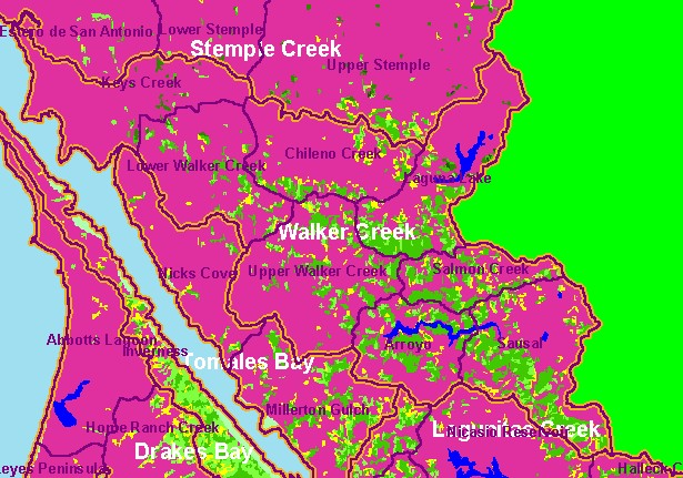
This is a map of 1994 USFS Landsat vegetation size data in the Walker Creek sub-basin. The vegetation classification is accurate
at a one-hectare scale (approximately 11 pixels) and is suitable for stand classification. The grassy areas near the mouth of Tomales
Bay, in the northern part of the basin and in patches elsewhere read as Non-Forest in this theme. Patches of trees ranging in size
from Saplings (<5" diameter) to Medium/Large Trees (20-29.9" diameter) fill the central and southern portions of the watershed.
Data provided by the U.S. Forest Service Spatial Analysis Lab in Sacramento, CA. Scale = 1:186,282 .
|
|
|
 |
 |
To view metadata about a map layer, click on a link in the table below.
| Name of Layer in Map Legend | Metadata File Name |
|---|
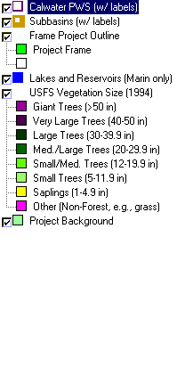
| Calwater PWS (w/ labels) | calw22.shp.txt |
| Subbasins (w/ labels) | subbasins.shp.txt |
| Frame Project Outline | Unavailable |
| Lakes and Reservoirs (Marin only) | Unavailable |
| USFS Riparian Veg Size (1994) | vegsizebuf.tif.txt |
| USFS Vegetation Size (1994) | vegsize.tif.txt |
| Topo Map, North (1:24k scale) | Unavailable |
| Topo Map, South (1:24k scale) | Unavailable |
| Project Background | Unavailable |
