Area/Topic  |  Bibliography   |  Background   |  Hypotheses   |  Home


KRIS West Marin-Sonoma: Map Page

Area Walker Creek
Topic Map: 1D. USFS Vegetation Size, Walker Creek Sub-basin 1994
 
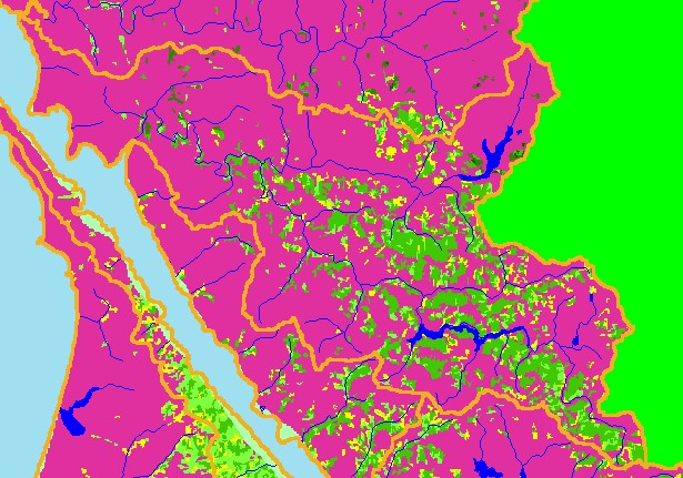
This is the 1994 USFS Landsat vegetation and tree size map for the Walker Creek sub-basin. Most of the northern and western basin extending Toward Tomales Bay is grasslands and pasture, which show as Non-Forest in this theme. Forests cover the hillslopes in the southern and eastern parts of the Walker Creek basin as higher relief brings higher rainfall, which makes forests thrive. Forests may also grow more vigorously in draws and on north facing slopes. The vegetation classification is accurate at a one-hectare scale (approximately 11 pixels) and is suitable for stand classification. Data provided by the U.S. Forest Service Spatial Analysis Lab in Sacramento, CA. Scale = 1:177,828 .


 To view metadata about a map layer, click on a link in the table below.
Name of Layer in Map LegendMetadata File Name
Subbasins (no labels) subbasins.shp.txt
Frame Project Outline Unavailable
Lakes and Reservoirs (Marin only) Unavailable
Streams (1:100k scale)(no labels) streams100.shp.txt
USFS Riparian Veg Size (1994) vegsizebuf.tif.txt
USFS Vegetation Size (1994) vegsize.tif.txt
Topo Map, North (1:24k scale) Unavailable
Topo Map, South (1:24k scale) Unavailable
Project Background Unavailable


  www.krisweb.com