| Area |
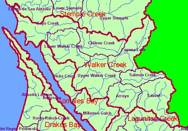
Walker Creek |
| Topic |
Land Cover: EPA Land Use in Walker Creek Sub-basin 1992 |
|
This is a map of the EPA Landcover/Landuse in the Walker Creek sub-basin from a 1992 Landsat image. This theme shows that
much of the northern basin is in pasture and grasslands. Other types of agricultural activity occur near Laguna Lake and Sausal
Creek. Data provided by the U.S. Environmental Protection Agency.
|
|
|
 |
 |
To view metadata about a map layer, click on a link in the table below.
| Name of Layer in Map Legend | Metadata File Name |
|---|
| Calwater PWS (w/ labels) | calw22.shp.txt |
| Subbasins (w/ labels) | subbasins.shp.txt |
| Streams (1:100k scale)(no labels) | streams100.shp.txt |
| Frame Project Outline | Unavailable |
| EPA Landcover, Aggregated (1992)(TIFF) | lndcov2.tif.txt |
| EPA Landcover, Unaggregated (1992)(TIFF) | lndcov.tif.txt |
| Topo Map, North (1:24k scale) | Unavailable |
| Topo Map, South (1:24k scale) | Unavailable |
| Project Area Background | Unavailable |
