| Area |
Walker Creek |
| Topic |
Tour: Historical Photos of the Town of Tomales |
 Click on image to enlarge (131K).
This is a photograph of Key's warehouse spanning Keys Creek in Lower Town, Tomales. In 1850, the creek was deep enough to be used by small ocean-going vessels up to the present intersection of Highway One and Tomales-Petaluma Road. Boats and barges came up from Tomales Bay to load at the warehouse, which was erected at the head of navigation in 1865. Gradually the creek silted up, and by the 1870's the shipping industry was abandoned. Photo taken in 1878 and provided courtesy of Tomales Regional History Center.
 Click on image to enlarge (103K). Click here to display a larger version (557K).
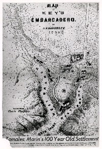
This map shows Key's "Embarcadero" where schooners landed at Tomales. John Keys has this picture map made in 1859. Map provided by the Tomales Regional History Center and courtesy of the Marin County Historical Society.
 Click on image to enlarge (35K). Click here to display a larger version (461K).
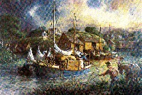
This painting by Richard Shell depicts the landing of John Keys' schooner, the "Spray," at Lower Town, Tomales. This vessel sailed between Bodega Bay, Tomales, and San Francisco shipping potatoes, grain, and dairy products. Keys carried on a shipping business from 1850-1875. The date of the painting is unknown. Print courtesy of Northbay Savings Bank and provided by the Tomales Regional History Center.
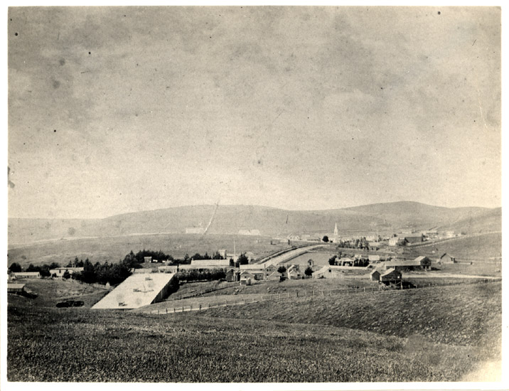
 Click on image to enlarge (32K). Click here to display a larger version (164K).
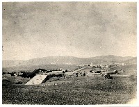
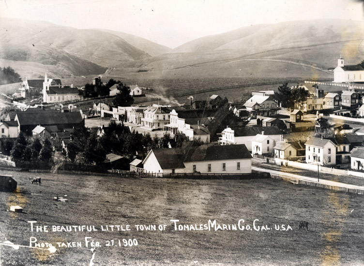
This is a photo of Tomales with Walker and Keys Creek valleys apparent in the top left. The population at this time was 400. Photo taken February 27, 1900 and provided courtesy of the Tomales Regional History Center.
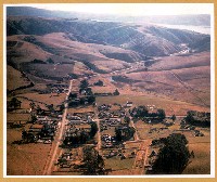 Click on image to enlarge (156K).
This is an aerial photograph of Tomales with Walker Creek entering Tomales Bay in the upper right. Key's warehouse shown in the previous pictures was located near the center of the picture. Photo taken circa 1949 and provided courtesy of the Tomales Regional History Center.
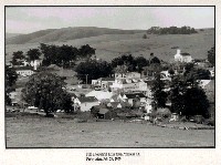 Click on image to enlarge (132K).
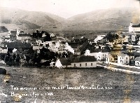
This is a photo of Tomales taken on February 27, 2000. Photo provided courtesy of the Tomales Regional History Center.
To learn more about this topic click Info Links
To view additional information (data source, aquisition date etc.) about this page, click Metadata

 Click on image to enlarge (131K).
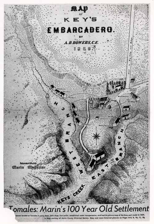 Click on image to enlarge (103K). Click here to display a larger version (557K).
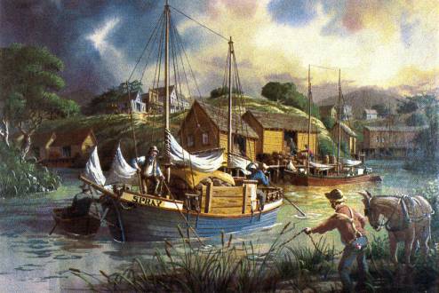 Click on image to enlarge (35K). Click here to display a larger version (461K).
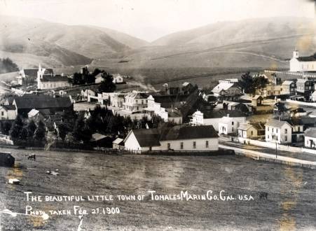 Click on image to enlarge (32K). Click here to display a larger version (164K).
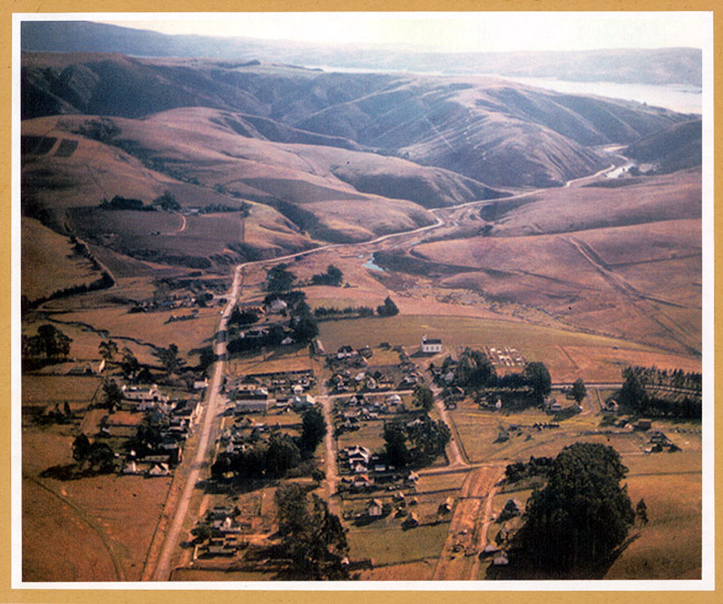 Click on image to enlarge (156K).
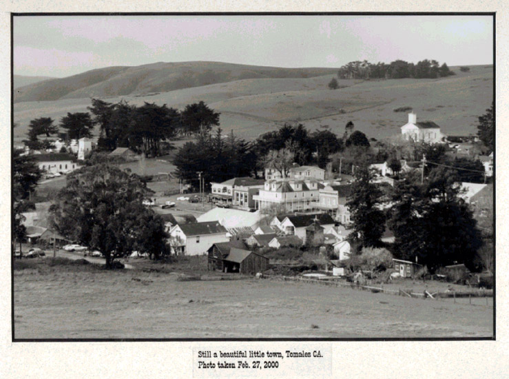 Click on image to enlarge (132K).
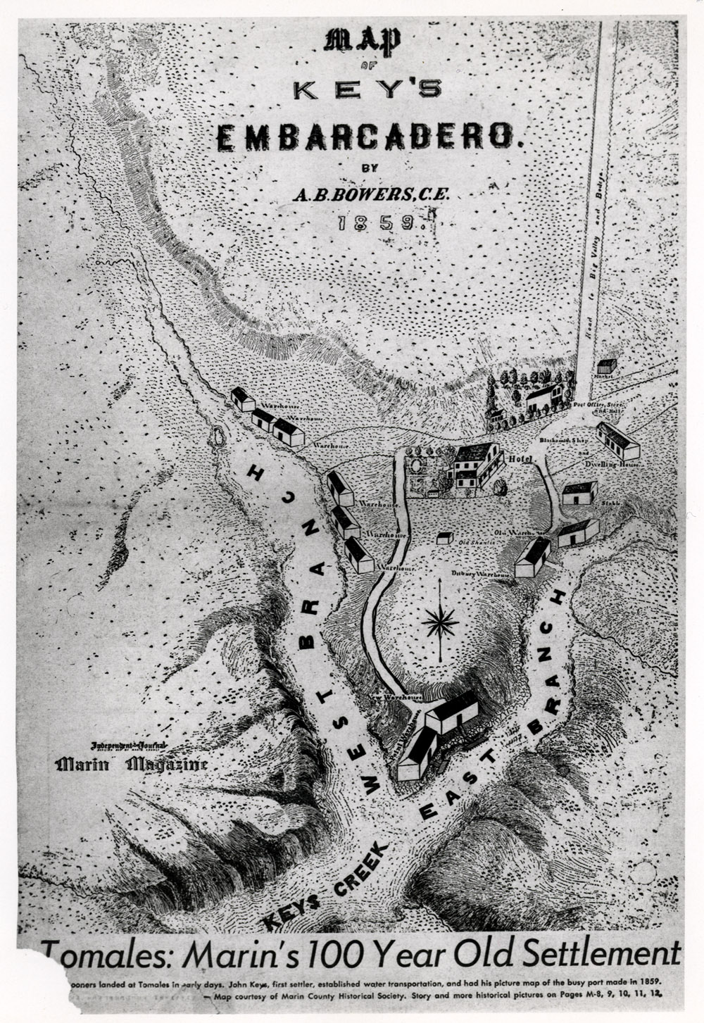