
| Area | Basinwide/Regional |
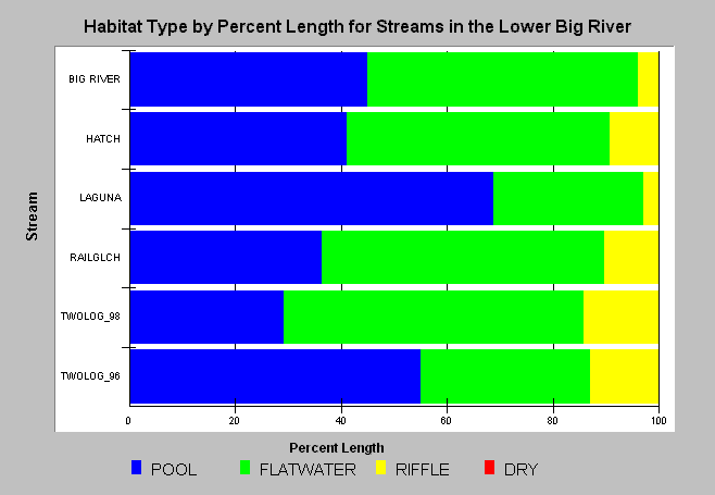
| Topic | Habitat: Lower Big River Habitat Types by Percent Length |
| Caption: The above chart shows the percent length of each stream survey in the Lower Big River area existing as four basic types of habitat, including DRY which describes dewatered riffles. Data provided by California Department of Fish and Game, Sacramento. Two Log Creek surveyed by Georgia Pacific in 1996. Click on Info Links for more information. | |
 |
To learn more about this topic click here .
To view the table with the chart's data, click Chart Table web page.
To download the table with the chart's data, click dfg_lb_hab.dbf (size 3,700 bytes) .
To see meta information about the data table used for this topic click here
To view the table with the chart's source data, click Source Table web page.
To download the table with the chart's source data, click habraw_big.dbf (size 5,051,928 bytes)
| www.krisweb.com |