
| Area | Basinwide/Regional |
| Topic | WQ: Conductance, Big River above LNF, 1959-1988 (StoRet) |
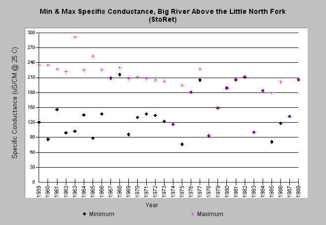
| Caption: This chart shows the yearly minimum and maximum values for specific conductance collected by the North Coast Regional Water Quality Control Board and the US Geological Survey at a site on the mainstem of the Big River, immediately above the confluence with the Little North Fork of the Big River. This chart was created by summarizing raw data obtained from US EPA's Legacy StoRet water quality database. Note that a large number of other compounds were sampled, but are not plotted here. The complete data set is available in the Source Table. Click the Info Links tab for more information. | |
 |
To learn more about this topic click here .
To view the table with the chart's data, click Chart Table web page.
To download the table with the chart's data, click storet_p95_minmax.db (size 4,096 bytes) .
To see meta information about the data table used for this topic click here
To view the table with the chart's source data, click Source Table web page.
To download the table with the chart's source data, click storet_wq.dbf (size 2,598,690 bytes)
| www.krisweb.com |