
| Area | Basinwide/Regional |
| Topic | Habitat: Average Percent Canopy |
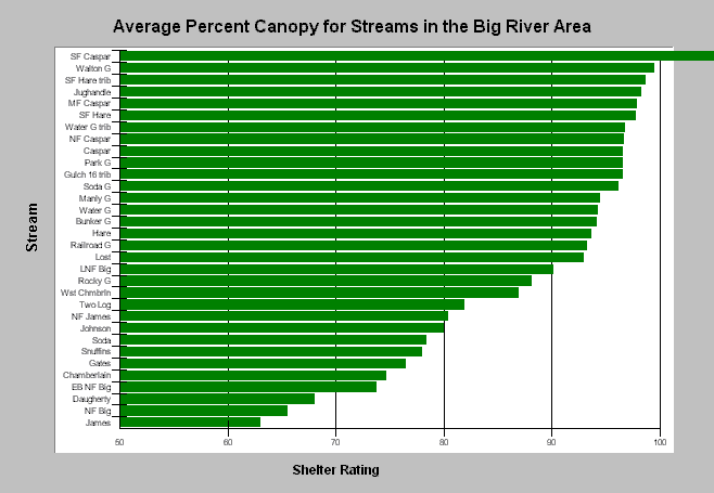
| Caption: The above values for average percent canopy cover were calculated from a query of CDFG data and may include errors from data collection or entry. The South Fork Caspar Creek value of 110% canopy, for example, is impossible. Among the other streams in the Big River area, canopy cover ranged from 99.5% (Walton Gulch) to 63% (James Creek). Eight streams had less than 80% canopy cover, a benchmark for salmonid streams noted by CDFG. See the Habitat box-plot topic for illustration of the variation associated with this parameter. Data provided by California Department of Fish and Game, Sacramento. Click on Info Links for more information. | |
 |
To learn more about this topic click here .
To view the table with the chart's data, click Chart Table web page.
To download the table with the chart's data, click habqry_big.dbf (size 40,610 bytes) .
To see meta information about the data table used for this topic click here
To view the table with the chart's source data, click Source Table web page.
To download the table with the chart's source data, click habraw_big.dbf (size 5,051,928 bytes)
| www.krisweb.com |