
| Area | Basinwide/Regional |
| Topic | Maps of Big River Basin - Geography |
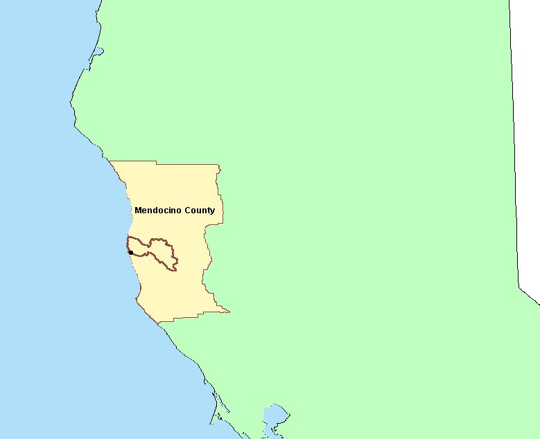
The image above shows the location of the KRIS Big River project area relative to Mendocino County and Northern California. Image captured from the KRIS Big River Map project in ArcView.
The image above is a shaded relief map of the KRIS Big River project area showing elevation in meters. Also shown are towns, streams and a quad sheet index. Derived from 10 meter DEMs provided by CDF FRAP. Image taken from the KRIS Big River Map project in ArcView.
The image above shows the KRIS Big River project area with sub-basins outlined in yellow. Note the sub-basins to the north of the Big River proper, including Caspar Creek and Hare Creek, which are composed of proximal tributaries to the Pacific Ocean. Big River sub-basins are adapted from Matthews and Associates (2001) and the North Coast Watershed Assessment Program. Shown in red is the Jackson Demonstration State Forest boundary which also extends into the adjacent Noyo River watershed (masked in green) to the north. Image taken from the KRIS Map ArcView project.
This image show the Calwater Planning Watersheds (purple outlines) that are contained in the Big River Watershed sub-basins (yellow outlines). The Jackson Demonstration State Forest boundary is shown in red.
This image from the KRIS Big River Map project shows USFS vegetation and stand types for the entire watershed derived from a 1994 Landsat (see USFS VegType Topics for more information). The large areas of Non-Forest in the west of the basin are the grassy coastal plain and rural residential areas. The upland oak forests and grassland in the east, are due to earthflow terrain in this region (see next Topic for Geology map), differing soil types and dry summers out of the fog belt. Some of the patches of mixed forest and shrubland disbursed throughout the remaining portion of the watershed reflects early seral conditions after timber harvest, and others show advanced stands of tanoak, madrone or alder. Jackson Demonstration State Forest in the west has a more prevalent signature of evergreen forest indicating a contiguous coniferous canopy.
The image above is from the EPA Land Cover project, which is included in the KRIS Big River Map project. The large areas of Non-Forest in the west of the basin are the grassy coastal plain and rural residential areas. The upland oak forests and grassland in the east, are due to earthflow terrain in this region (see next Topic for Geology map), differing soil types and dry summers out of the fog belt. Some of the patches of mixed forest and shrubland disbursed throughout the remaining portion of the watershed reflects early seral conditions after timber harvest, and others show advanced stands of tanoak, madrone or alder. Jackson Demonstration State Forest in the west has a more prevalent signature of evergreen forest indicating a contiguous coniferous canopy.
This image shows the rainfall isopleths for the Big River watershed. While rainfall on the coast is only about 40 inches per year, interior basin areas receive as much as 50 inches or more. This layer was generated by the Oregon Climate Service at Oregon State University from 1961-1990 rainfall data.
The stream gradient theme for the Big River basin is shown above with a USGS topographical map backdrop. The entire mainstem reaches of the Big River are predominantly low gradient and, therefore optimal for use by coho salmon. Steeper areas of the watershed in the north and east have headwaters streams with greater than 20% gradient, which are termed supply reaches because sediment is conveyed whenever delivered from hillslopes. Derived from 10 meter DEM supplied by CDF FRAP.
 Click on image to enlarge (21K).
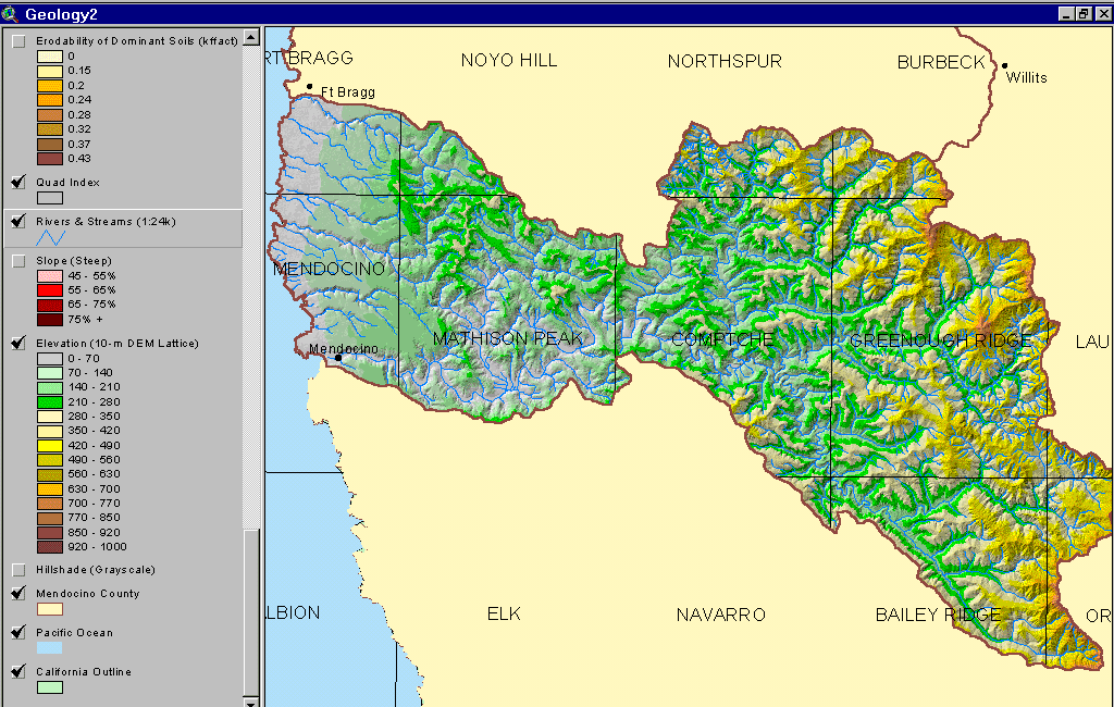 Click on image to enlarge (148K).
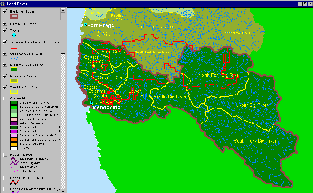 Click on image to enlarge (49K).
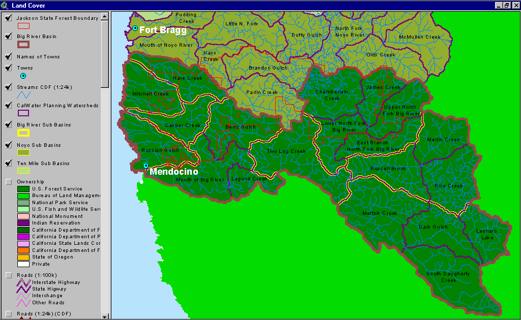 Click on image to enlarge (56K).
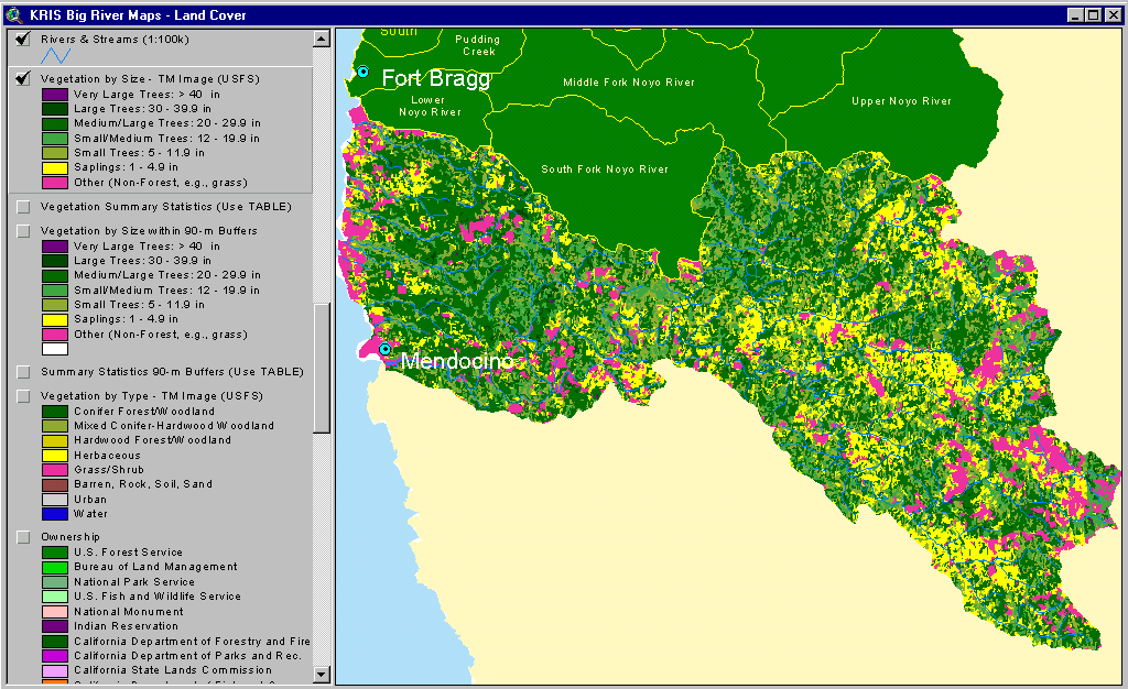 Click on image to enlarge (81K).
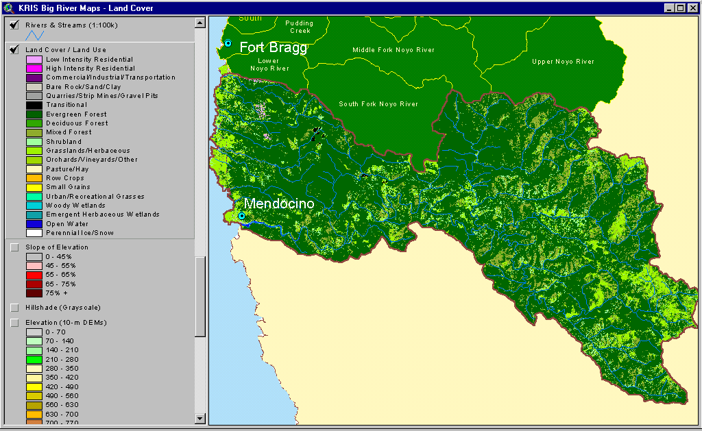 Click on image to enlarge (69K).
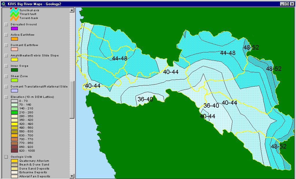 Click on image to enlarge (43K).
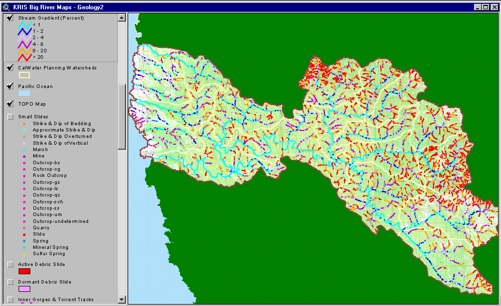 Click on image to enlarge (179K).
To learn more about this topic click here
| www.krisweb.com |