| Area |
Basinwide/Regional |
| Topic |
Sediment: Matthews Road Construction All Sub-basins 1921-2000 |
 Click on image to enlarge (91K). Click here to display a larger version (169K).
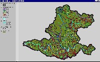
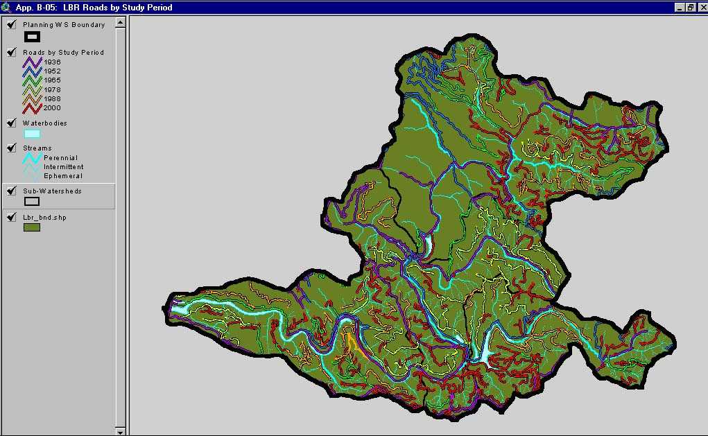
This image, from Matthews and Associates (2001) Appendix B-5, shows roads and construction period in the Lower Big River Planning Watershed. The Lower Big River Planning Watershed is the western portion of the Lower Big River CalWater sub-basin. This Planning Watershed has a road density of 7.65 mi/sq mi, exceeding the properly functioning condition set by the National Marine Fisheries Service (1996), which is less than 3 mi/sq mi.
 Click on image to enlarge (138K).
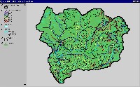
This image, from Matthews and Associates (2001) Appendix B-4, shows roads and construction period in the Middle Big River Planning Watershed. The Middle Big River Planning Watershed is the eastern portion of the Lower Big River CalWater sub-basin. This Planning Watershed has a road density of 8.64 mi/sq mi, which exceeds the properly functioning condition set by the National Marine Fisheries Service (1996), which is less than 3 mi/sq mi.
 Click on image to enlarge (104K). Click here to display a larger version (192K).
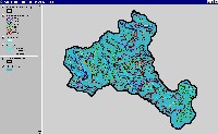
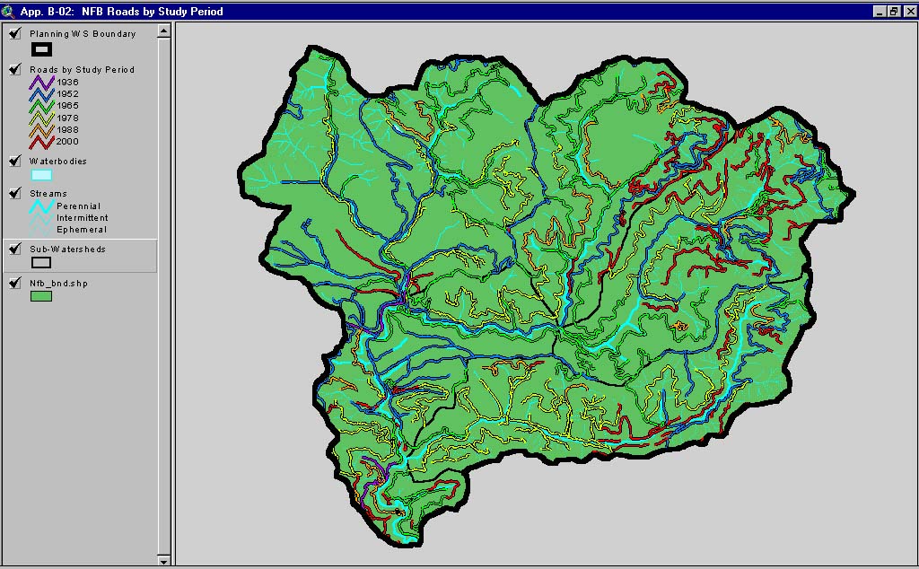
This image, from Matthews and Associates (2001) Appendix B-2, shows roads and construction period in the North Fork Big River Planning Watershed. The North Fork Planning Watershed is also the North Fork Big River CalWater sub-basin. This Planning Watershed has a road density of 6.64 mi/sq mi, which exceeds the properly functioning condition set by the National Marine Fisheries Service (1996), which is less than 3 mi/sq mi.
 Click on image to enlarge (98K). Click here to display a larger version (180K).
This image, from Matthews and Associates (2001) Appendix B-1, shows roads and construction period in the Headwaters Big River Planning Watershed. The Headwaters Planning Watershed is also the Upper Big River CalWater sub-basin. This Planning Watershed has a road density of 7.13 mi/sq mi, which exceeds the properly functioning condition set by the National Marine Fisheries Service (1996), which is less than 3 mi/sq mi.
 Click on image to enlarge (89K). Click here to display a larger version (167K).
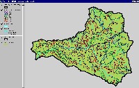
This image, from Matthews and Associates (2001) Appendix B-3, shows roads and construction period in the South Fork Big River Planning Watershed. The South Fork Planning Watershed includes the South Fork Big River and the Daugherty Creek CalWater sub-basin. This Planning Watershed has a road density of 5.81 mi/sq mi, which exceeds the properly functioning condition set by the National Marine Fisheries Service (1996), which is less than 3 mi/sq mi.
 Click on image to enlarge (139K).
This image shows the location of the historical railroads in the Big River watershed. The railroads were used to transport harvested timber between about 1885 and 1930. The railroad network show here is from Matthews and Associates (2001), Figure 34.
To learn more about this topic click here

 Click on image to enlarge (91K). Click here to display a larger version (169K).
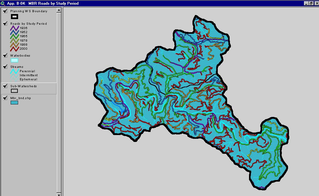 Click on image to enlarge (138K).
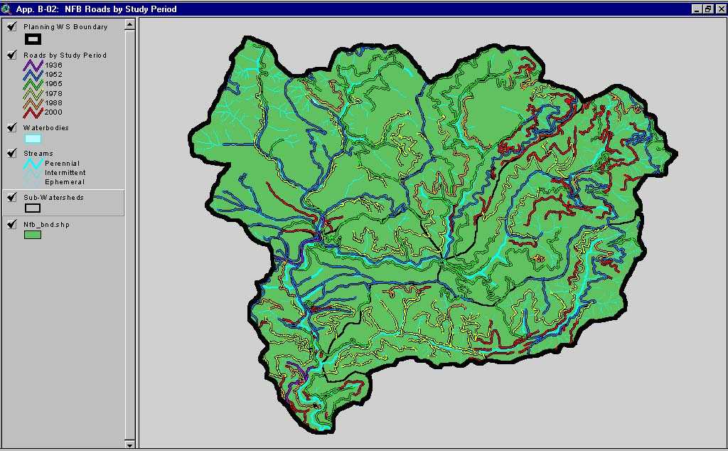 Click on image to enlarge (104K). Click here to display a larger version (192K).
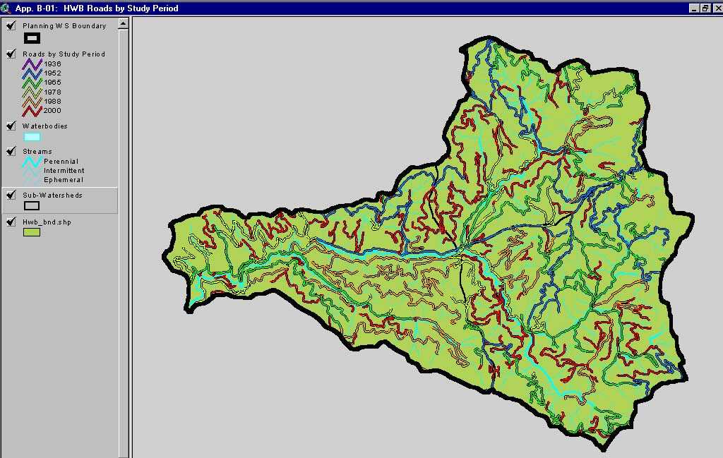 Click on image to enlarge (98K). Click here to display a larger version (180K).
 Click on image to enlarge (89K). Click here to display a larger version (167K).
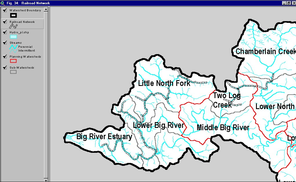 Click on image to enlarge (139K).
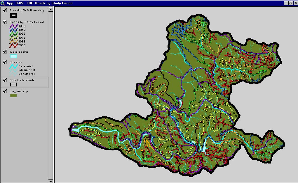