| Area |
Basinwide/Regional |
| Topic |
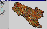
Sediment: Matthews Road Densities All Big River Sub-basins 2000 |
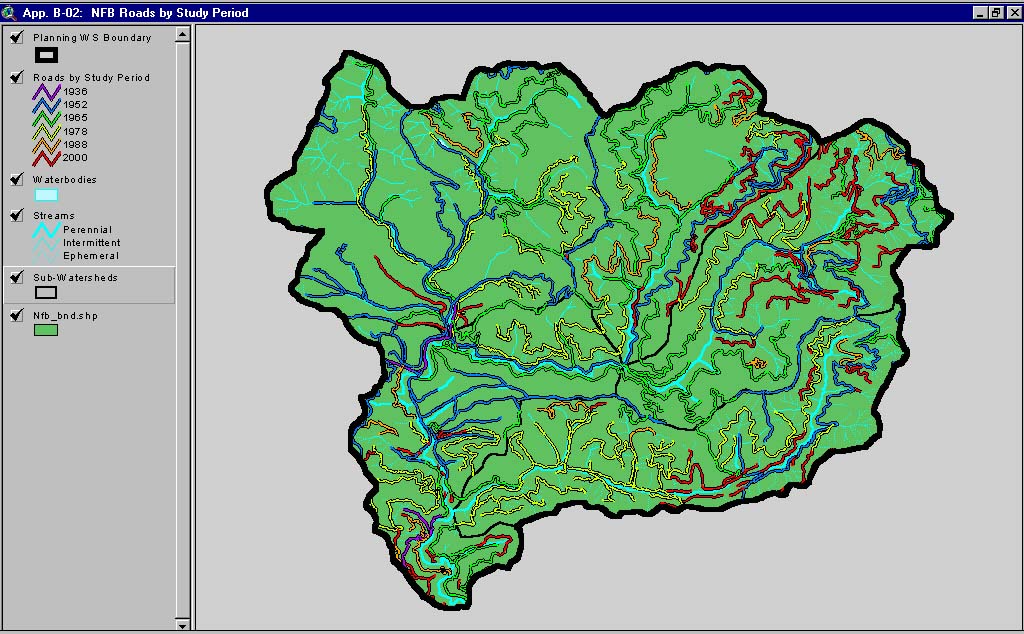
 Click on image to enlarge (91K). Click here to display a larger version (169K).
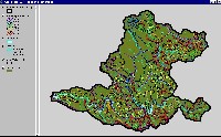
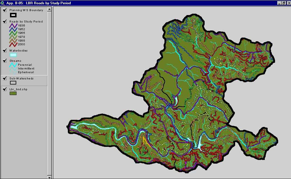
This image, from Matthews and Associates (2001) Appendix B-5, shows roads and construction period in the Lower Big River Planning Watershed. The Lower Big River Planning Watershed is the western portion of the Lower Big River CalWater sub-basin and also contains the Little North Fork CalWater sub-basin. This Planning Watershed has a road density of 7.65 mi/sq mi, exceeding the properly functioning condition set by the National Marine Fisheries Service (1996), which is less than 3 mi/sq mi.
 Click on image to enlarge (138K).
This image, from Matthews and Associates (2001) Appendix B-4, shows roads and construction period in the Middle Big River Planning Watershed. The Middle Big River Planning Watershed is the eastern portion of the Lower Big River CalWater sub-basin. This Planning Watershed has a road density of 8.64 mi/sq mi, which exceeds the properly functioning condition set by the National Marine Fisheries Service (1996), which is less than 3 mi/sq mi.
 Click on image to enlarge (104K). Click here to display a larger version (192K).
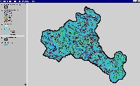
This image, from Matthews and Associates (2001) Appendix B-2, shows roads and construction period in the North Fork Big River Planning Watershed. The North Fork Planning Watershed is also the North Fork Big River CalWater sub-basin. This Planning Watershed has a road density of 6.64 mi/sq mi, which exceeds the properly functioning condition set by the National Marine Fisheries Service (1996), which is less than 3 mi/sq mi.
 Click on image to enlarge (98K). Click here to display a larger version (180K).
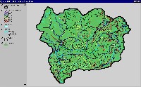
This image, from Matthews and Associates (2001) Appendix B-1, shows roads and construction period in the Headwaters Big River Planning Watershed. The Headwaters Planning Watershed is also the Upper Big River CalWater sub-basin. This Planning Watershed has a road density of 7.13 mi/sq mi, which exceeds the properly functioning condition set by the National Marine Fisheries Service (1996), which is less than 3 mi/sq mi.
 Click on image to enlarge (89K). Click here to display a larger version (167K).
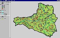
This image, from Matthews and Associates (2001) Appendix B-3, shows roads and construction period in the South Fork Big River Planning Watershed. The South Fork Planning Watershed includes the South Fork Big River and the Daugherty Creek CalWater sub-basin. This Planning Watershed has a road density of 5.81 mi/sq mi, which exceeds the properly functioning condition set by the National Marine Fisheries Service (1996), which is less than 3 mi/sq mi.
To learn more about this topic click here

 Click on image to enlarge (91K). Click here to display a larger version (169K).
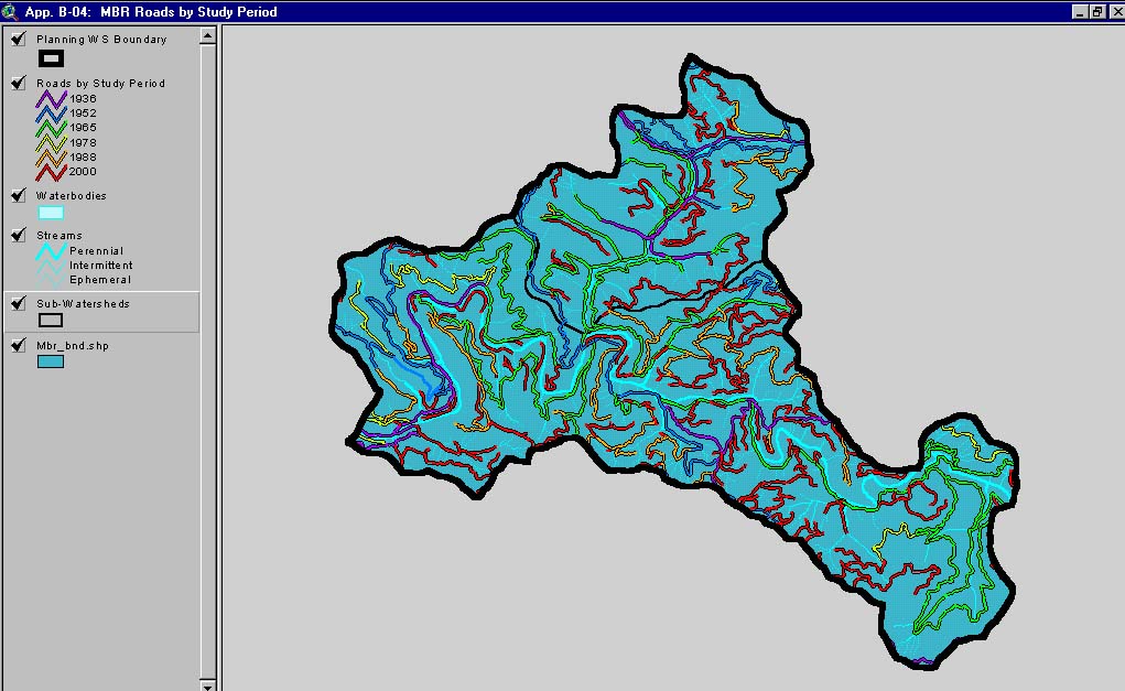 Click on image to enlarge (138K).
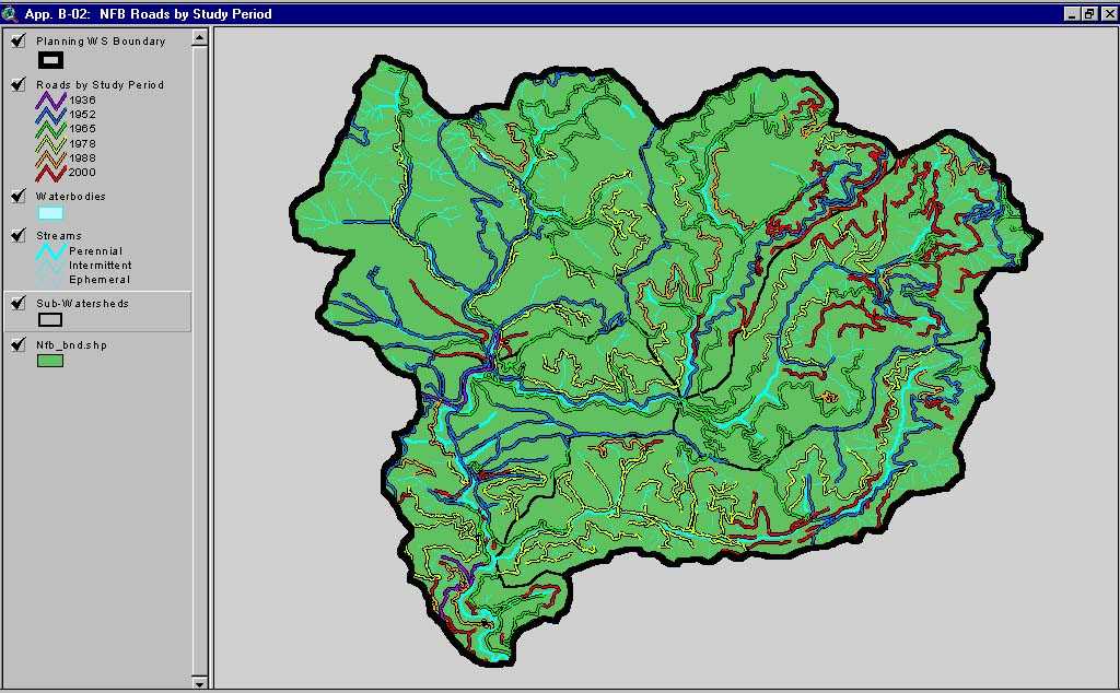 Click on image to enlarge (104K). Click here to display a larger version (192K).
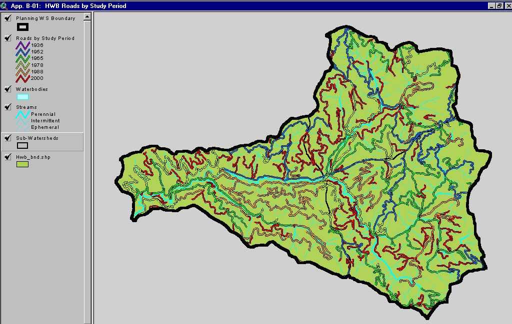 Click on image to enlarge (98K). Click here to display a larger version (180K).
 Click on image to enlarge (89K). Click here to display a larger version (167K).
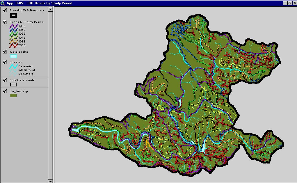