
| Area | Basinwide/Regional |
| Topic | Maps of Big River Basin - Matthews Sediment Source Assessment |
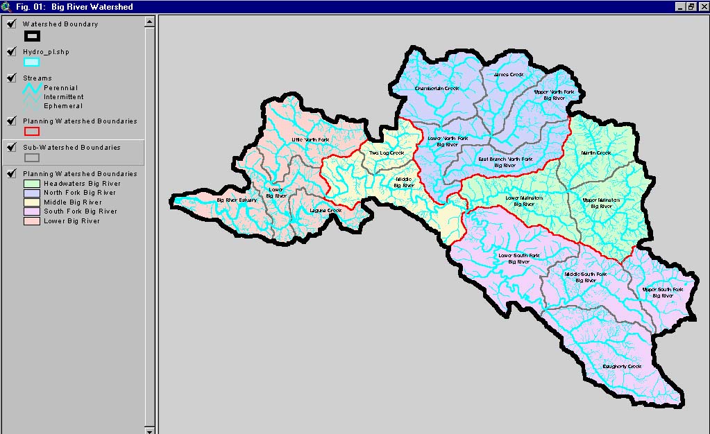
This is an image of the basin delineations used in Matthews and Associates (2001) sediment source analysis. The colored regions were termed Planning Watersheds by Matthews but represent Sub-basins in KRIS and by the North Coast Watershed Assessment Program. Grey lines are used to delineate Calwater units that Matthews termed sub-basins. Thus Matthews "sub-basins" in his report and in some of the Matthews topics in KRIS are actually the Calwater planning watersheds.
This map, from Matthews and Associates (2001), shows major landowners in the Big River watershed.
This map, from Matthews and Associates (2001), shows historic railroads in the Big River watershed.
This map, from Matthews and Associates (2001), shows topography in the Big River watershed. Sub-basins are outlined in red. CalWater planning watersheds are outlined in gray.
 Click on image to enlarge (136K).
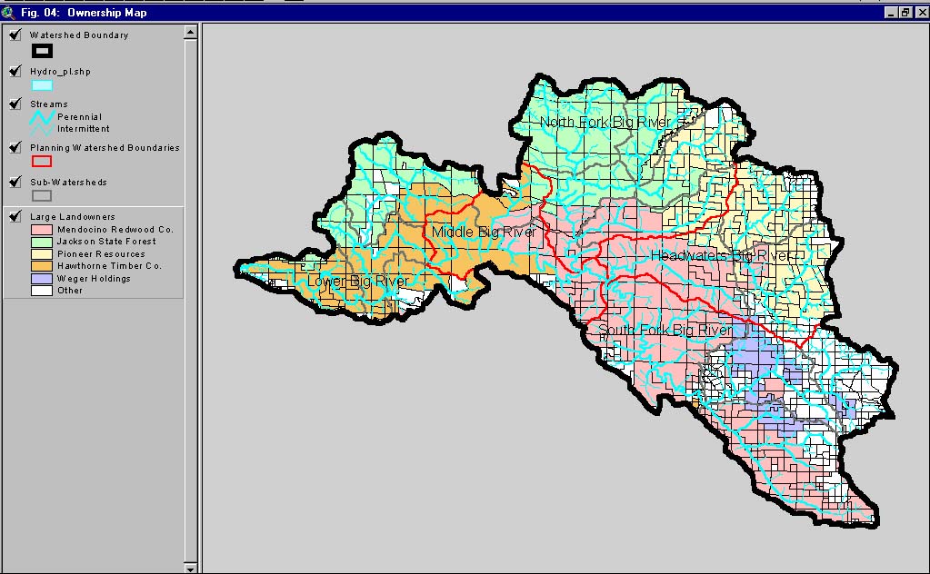 Click on image to enlarge (156K).
 Click on image to enlarge (106K).
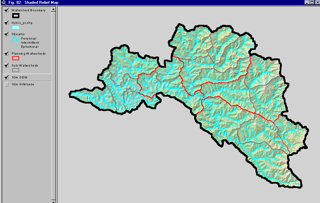 Click on image to enlarge (166K).
To learn more about this topic click here
| www.krisweb.com |