| Area |
Basinwide/Regional |
| Topic |
Sediment: Matthews Road Surface Type for All Sub-basins 2000 |
 Click on image to enlarge (88K). Click here to display a larger version (163K).
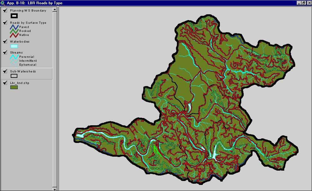
This image, from Matthews and Associates (2001) Appendix B-10, road surface type in the Lower Big River Planning Watershed. The Lower Big River Planning Watershed includes the western portion of the Lower Big CalWater basin and the Little North Fork CalWater sub-basin.
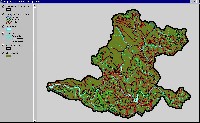
 Click on image to enlarge (136K).
This image, from Matthews and Associates (2001) Appendix B-9, road surface type in the Middle Big River Planning Watershed. The Middle Big River Planning Watershed includes the eastern portion of the Lower Big CalWater basin.
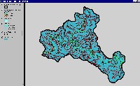
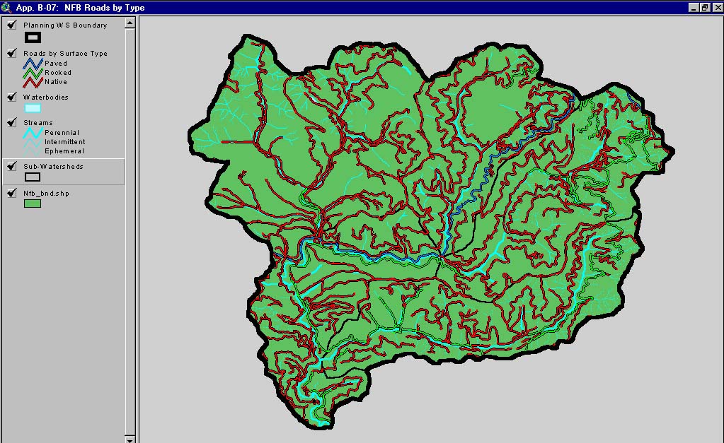
 Click on image to enlarge (99K). Click here to display a larger version (183K).
This image, from Matthews and Associates (2001) Appendix B-7, road surface type in the North Fork Big River Planning Watershed. The North Fork Big River Planning Watershed is the North Fork Big CalWater basin.
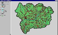
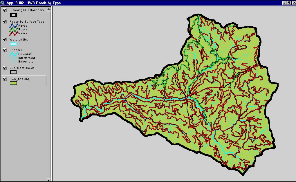
 Click on image to enlarge (92K). Click here to display a larger version (168K).
This image, from Matthews and Associates (2001) Appendix B-6, road surface type in the Headwaters Big River Planning Watershed. The Headwaters Big River Planning Watershed is the Upper Big CalWater basin.
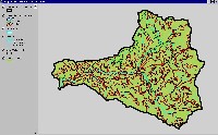
 Click on image to enlarge (151K).
This image, from Matthews and Associates (2001) Appendix B-8, road surface type in the South Fork Big River Planning Watershed. The South Fork Big River Planning Watershed includes the South Fork and Daugherty Creek CalWater sub-basin.
To learn more about this topic click here

 Click on image to enlarge (88K). Click here to display a larger version (163K).
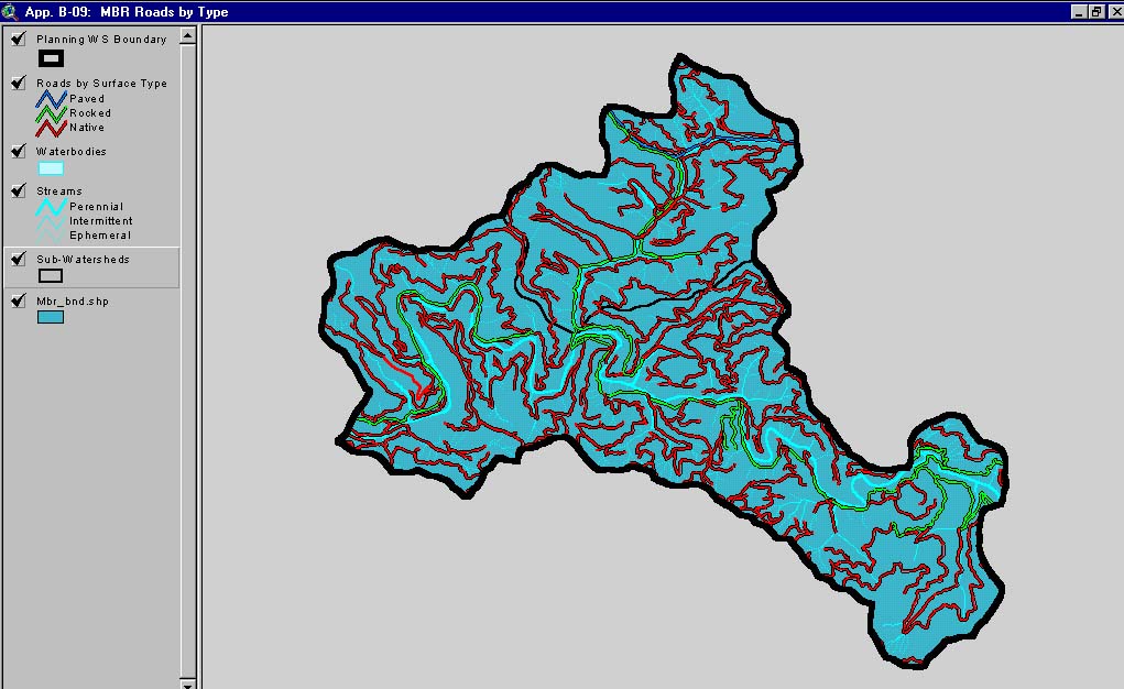 Click on image to enlarge (136K).
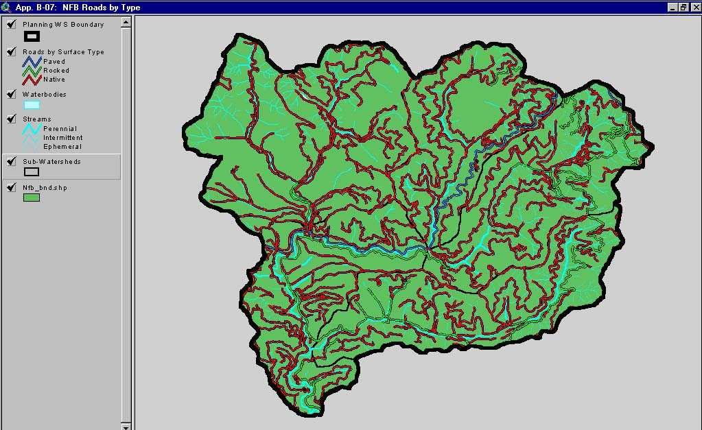 Click on image to enlarge (99K). Click here to display a larger version (183K).
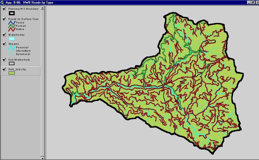 Click on image to enlarge (92K). Click here to display a larger version (168K).
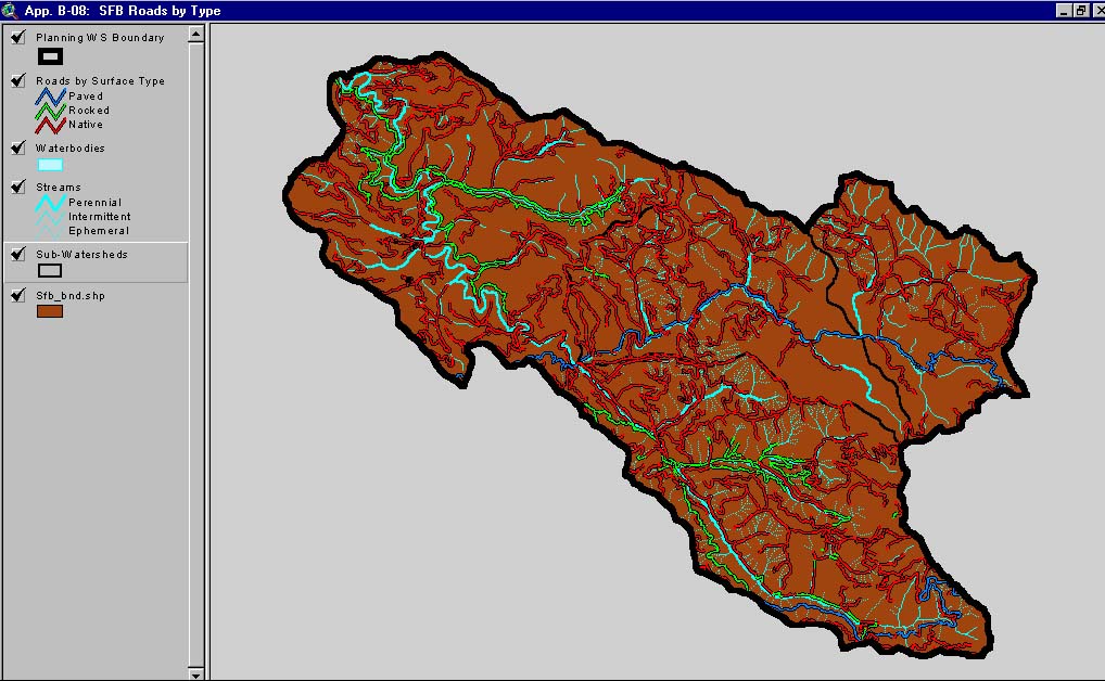 Click on image to enlarge (151K).
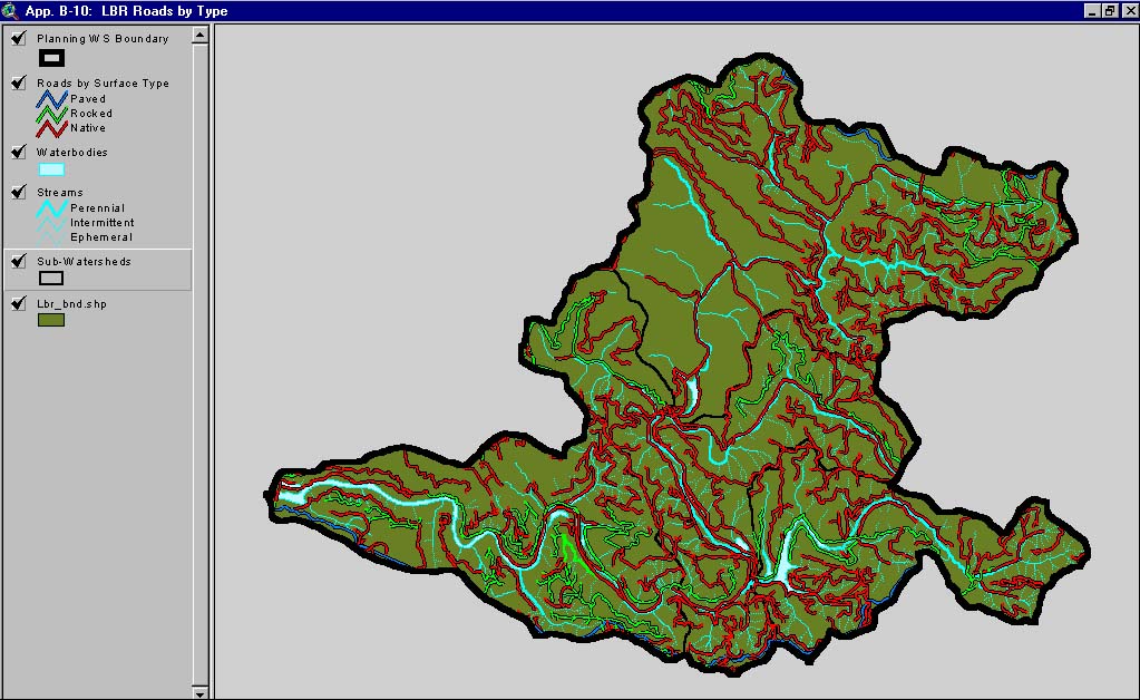