| Area |
Basinwide/Regional |
| Topic |
Tour: Timber Harvest Aerial Photos |
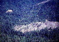 Click on image to enlarge (91K). Click here to display a larger version (926K).
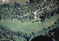
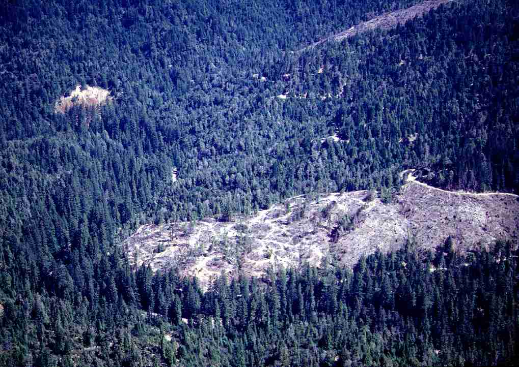
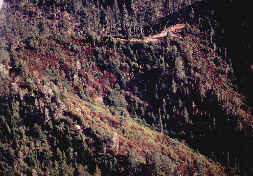
A slide along the lower mainstem Big River shows in the upper left corner of the photo just downstream of Blind Gulch. Recent clear-cut unit in foreground of photo appears to have been yarded with tractors on the left, and cable yarded on the right. Trees along draws in the cut areas reflect Class III stream protections. Photo by Rixanne Wehren. 1994.
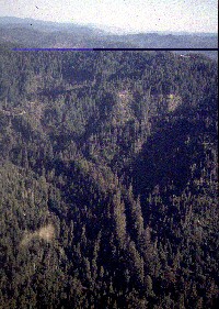 Click on image to enlarge (49K). Click here to display a larger version (717K).
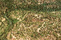
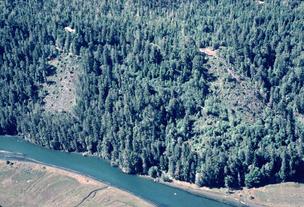
Photo of unknown area within Big River watershed showing large trees in the riparian zone of the stream, which extends from the center toward the bottom, right. Recent clear cuts with cable yarding are visible up and to the right of center in the photograph. Most of the watershed in view appears to be in very early seral conditions. Photo by Rixanne Wehren. 1994
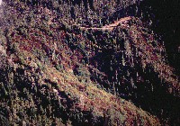 Click on image to enlarge (107K). Click here to display a larger version (468K).
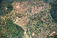
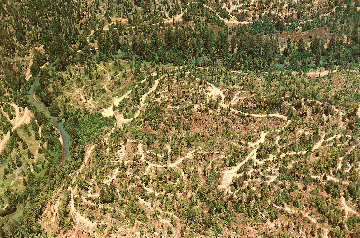
Aerial close up of areas recently clear-cut after application of herbicides. The herbicides target Ceanothus, a brush species that tends to colonize light gaps but is also a nitrogen fixer. Photo by Rixanne Wehren. 1994.
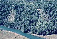 Click on image to enlarge (148K). Click here to display a larger version (266K).
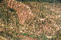
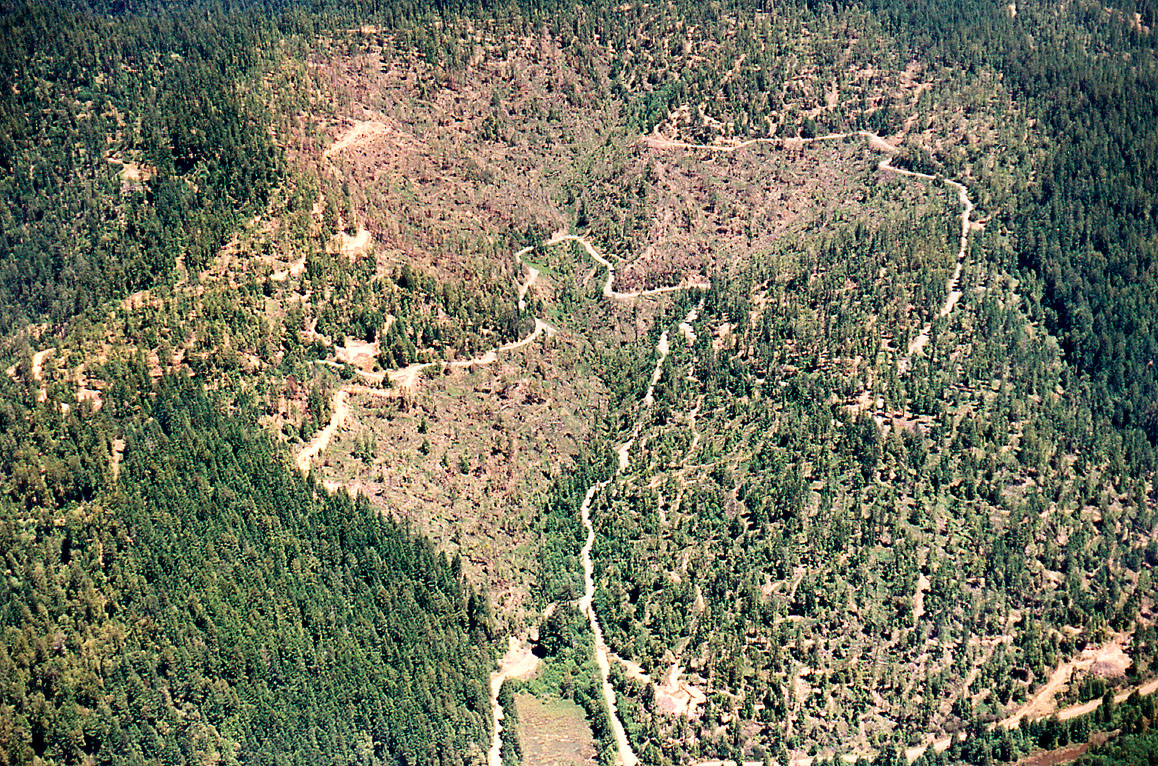
Close up of lower Big River showing recent logging. The logging on these slopes appears to have been conducted using the cable yarding method. The slopes are beginning to re-vegetate. Note the trees left along the river for the Watercourse and Lake Protection Zone. Photo by David Russell. 1995.
 Click on image to enlarge (112K). Click here to display a larger version (280K).
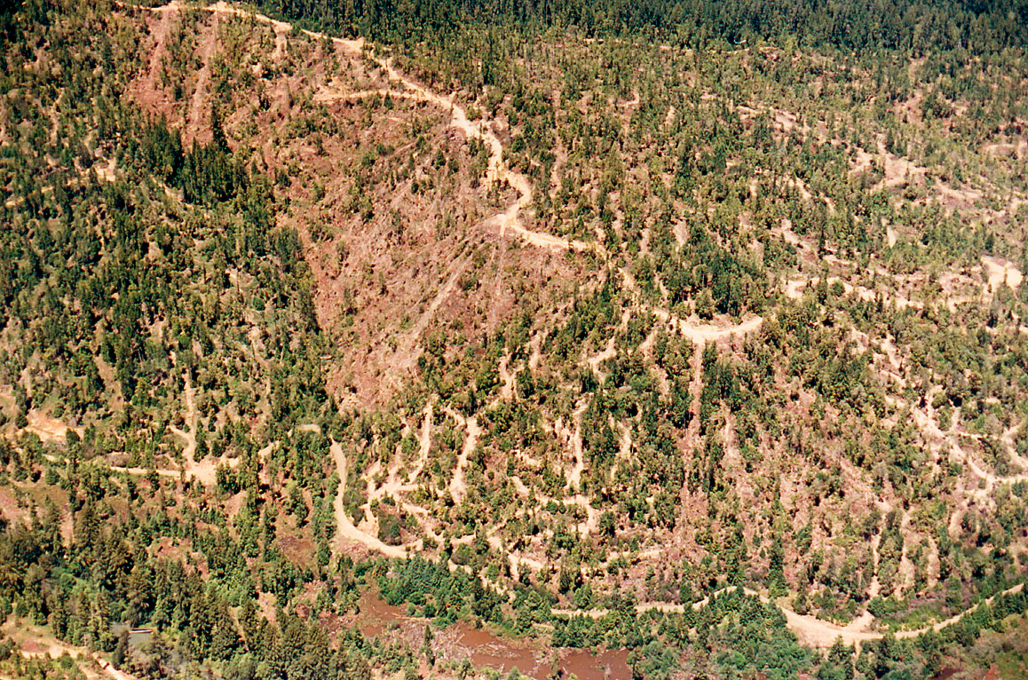
This aerial photo was taken approximately three to four miles up Big River and shows a recently logged slope back away from the stream. Although a small landslide appears to have resulted from a logging road failure, delivery of sediment reached the flood plain but not the stream. The deciduous riparian buffer near the pasture appears to provide filter capacity and would be sufficient to prevent bank erosion by livestock. Photo by Rixanne Wehren. June 1999.
 Click on image to enlarge (129K). Click here to display a larger version (646K).
Aerial view of Big River (lower left to upper right) looking southwest at Hansen's Curve, tip of High Chute Ridge, N39ş17.1' W123ş42.6'. The unit was harvested with tractors. Photo courtesy of and copyright by Nick Wilson. June 1990.
 Click on image to enlarge (151K). Click here to display a larger version (812K).
Aerial view of Georgia Pacific logging on west flank of High Chute Ridge, looking east up next gulch upstream from Dry Dock Gulch. Big River North Side Road loops up and down at bottom center, with tip of loop at N39ş17.8' W123ş43.3'. Three of the units were logged by tractor. The middle area of the photo was logged by cable yarders, and a haul road traverses the units. Photo courtesy of and copyright by Nick Wilson. June 1990.
 Click on image to enlarge (129K). Click here to display a larger version (622K).
Aerial view looking north at High Chute Ridge just above Hansen's Curve and below Laguna. Big River visible near lower left corner, with taller trees left along banks as required by Forest Practice Rules. Big River North Side Road crosses bottom of view with tip of loop seen left of center at N39ş17.2' W123ş42.1'. The marsh is on the river flat. Tractor and cable yarding on lands of Georgia Pacific. Photo courtesy of and copyright by Nick Wilson. June 1990."

 Click on image to enlarge (91K). Click here to display a larger version (926K).
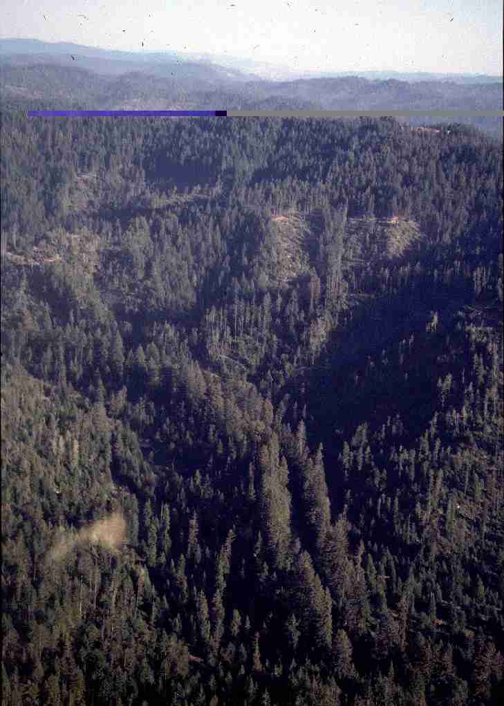 Click on image to enlarge (49K). Click here to display a larger version (717K).
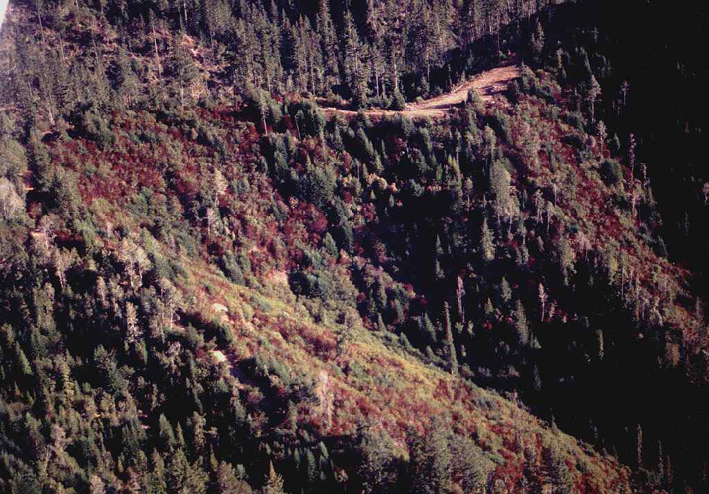 Click on image to enlarge (107K). Click here to display a larger version (468K).
 Click on image to enlarge (148K). Click here to display a larger version (266K).
 Click on image to enlarge (112K). Click here to display a larger version (280K).
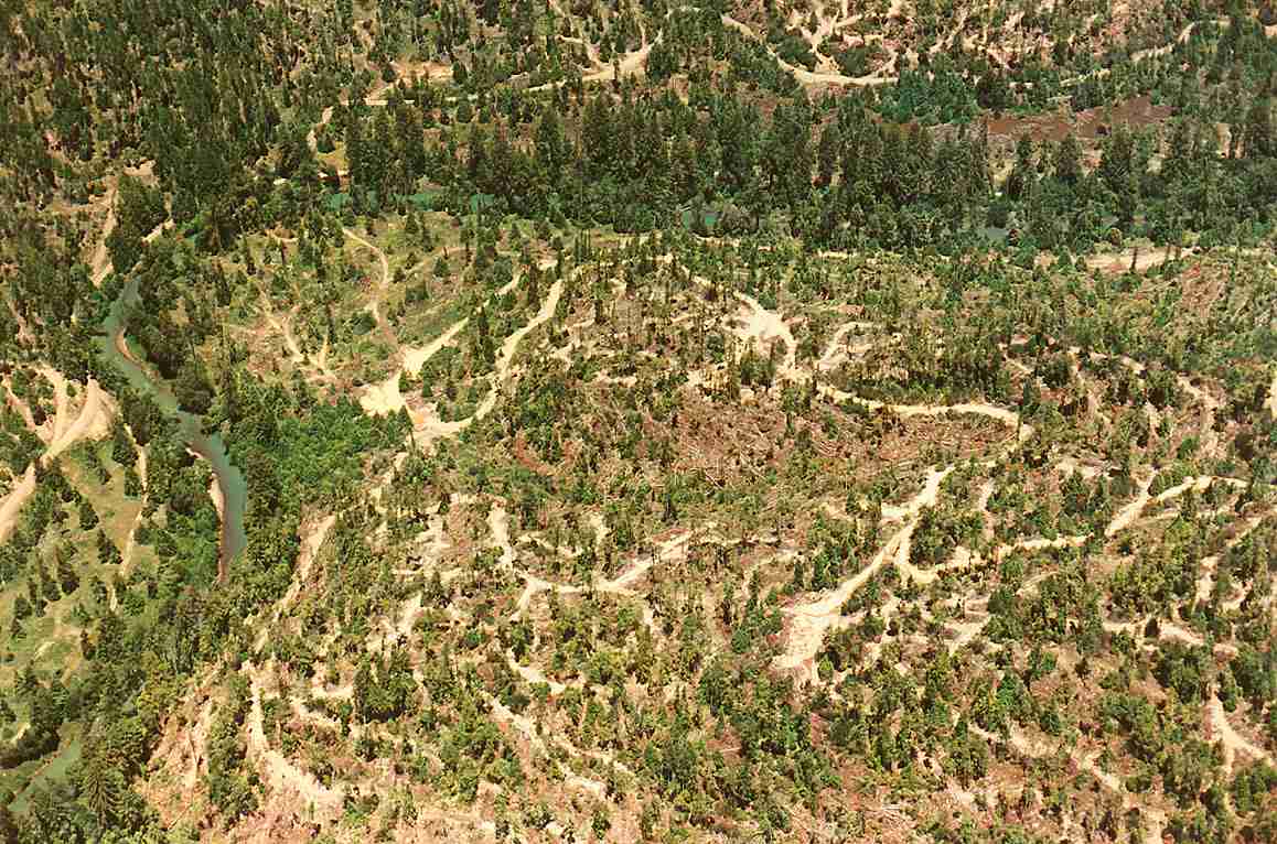 Click on image to enlarge (129K). Click here to display a larger version (646K).
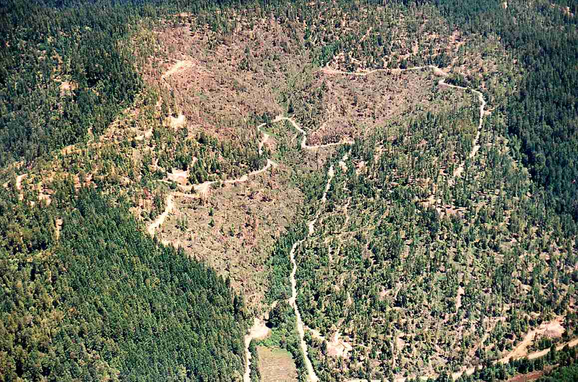 Click on image to enlarge (151K). Click here to display a larger version (812K).
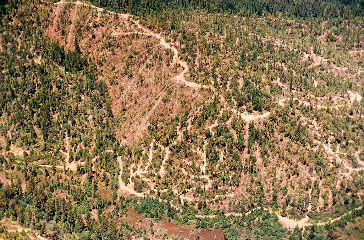 Click on image to enlarge (129K). Click here to display a larger version (622K).
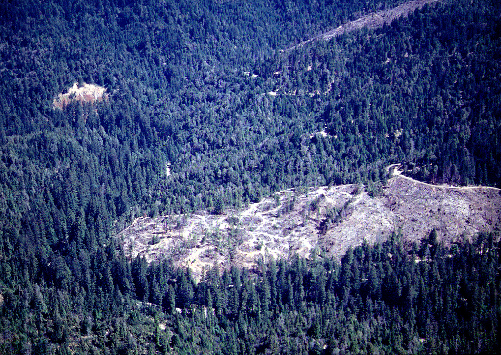