
| Area | Caspar Creek |
| Topic | Sediment: Caspar Creek Cross Section 61+60, 1987-1999 Ribbon View |
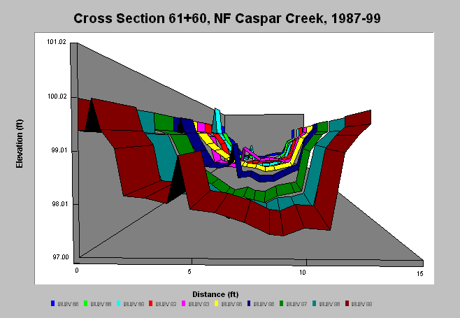
| Caption: At XS 61+60, in 1989, the channel degraded only to experience aggradation by 1992. In 1997, the channel again degraded to the 1989 elevation. This could suggest a pulse of sediment about a foot deep moved through the system at this location between 1989 and 1996. Scrutinizing the other 61 channel cross-section stations along the main stem of the North Fork of Caspar Creek may yield interesting trends. The referenced data set contains survey data for these cross-sections from 1986-1999. Additional data is in press (2001). Between 1986-1999, surveys were conducted every year except 1987 and 1994. | |
 |
To learn more about this topic click here .
To view the table with the chart's data, click Chart Table web page.
To download the table with the chart's data, click xs61_60.dbf (size 5,105 bytes) .
To see meta information about the data table used for this topic click here
To view the table with the chart's source data, click Source Table web page.
To download the table with the chart's source data, click rsl_xs_source.dbf (size 2,156,998 bytes)
| www.krisweb.com |