
| Area | Caspar Creek |
| Topic | Sediment: Caspar Creek Suspended Sediment Yield by Year,1963-1999 |
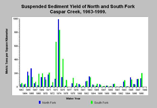
| Caption: The above chart shows annual Suspended Sediment, in metric tons per square kilometer, measured at the North and South Fork Weirs from the period 1963-1999. Data collected by Redwood Sciences Lab. Landslides were known to deliver large amounts of sediment to the South Fork in 1973 and to the North Fork in 1995. Click on Info Links for more information. | |
 |
To learn more about this topic click here .
To view the table with the chart's data, click Chart Table web page.
To download the table with the chart's data, click rslsum.dbf (size 6,518 bytes) .
To see meta information about the data table used for this topic click here
| www.krisweb.com |