
| Area | Caspar Creek |
| Topic | Sediment: Fines <0.85mm in 1967, 1968, 1969 and 1993 |
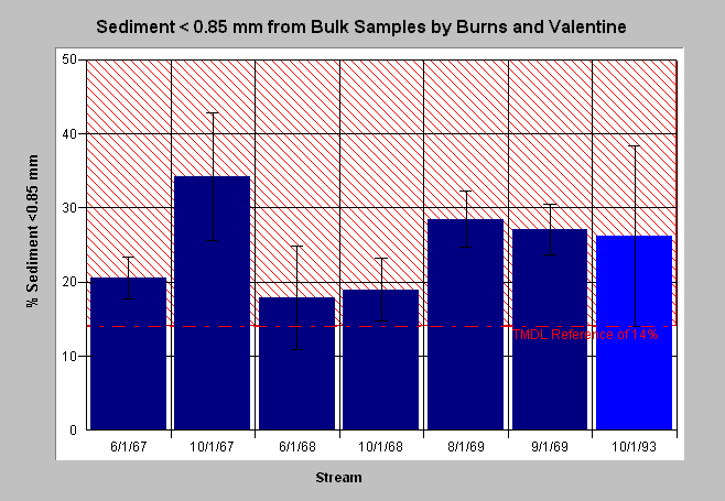
| Caption: Wet sieve bulk samples from Burns (1970) in South Fork of Caspar Creek. Burns attributes the 13.6% increase in the South Fork between June and October of 1967 to road construction, and the 8.8% increase over pre-disturbance levels in 1969 to heavy rainfall following harvest and tractor operations in the stream zone. In 1993, Valentine repeated Burns' study in the South Fork. | |
 |
To learn more about this topic click here .
To view the table with the chart's data, click Chart Table web page.
To download the table with the chart's data, click sed85_burns.dbf (size 807 bytes) .
To see meta information about the data table used for this topic click here
| www.krisweb.com |